Bootjack Mountain and Highchair Mountain - 8.25.2009
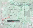
Park at the Doctor Creek washout on the Icicle Creek road... then ride a mountain bike for 4.3 miles to the trailhead (2900')... which is just east of the Blackpine Creek Horse Camp.
|
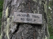
Hike for an eighth of a mile on the Jackpine Trail #1597.
|
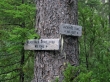
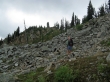
Now take the Blackjack Ridge Trail #1565 and start switchbacking towards Blackjack Ridge.
|
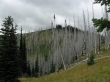
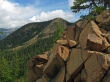
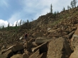
Around 6000 feet, views start to open up.
|
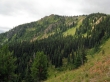
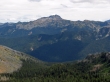
Bootjack Mtn from the Blackjack Ridge Trail.
|
madman nears the Bootjack Mtn summit (6789').
|
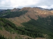
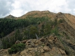
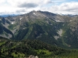
Highchair Mtn and the ridge that connects it to Bootjack Mtn.
|
madman on the ridge and heading for Highchair Mtn...
|
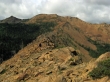
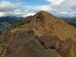
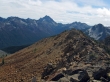
Looking back on Bootjack Mtn from the ridge leading to Highchair Mtn.
|
We are near the low point (~6400') on the ridge and will hold our elevation and hike into the treed basin below the summit.
|
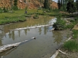
The tadpole tarn is alive and well in the Highchair basin.
|
Looking back on Bootjack Mtn from above the Highchair basin.
|
madman is working his way up to the ridge south of the Highchair summit.
|
madman on the ridge south of the Highchair summit.
|
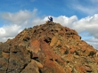
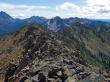
madman on the Highchair Mtn summit (7016').
|
A closeup of Grindstone Mtn... Cape Horn is on the far left above Ladies Pass.
|
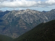
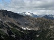
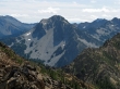
Cashmere Mtn from Highchair Mtn.
|
The Cradle with Mt. Daniel in the distance... the twin summits on the right is Granite Mtn.
|
A closeup of Mt. Daniel.
|
Looking north along Sixtysix Hundred Ridge.
|
|
A pano shot from Mt. Cashmere on the left to Harding Mtn and Fish Eagle Peak on the right.
|
Jack Ridge, Mt. Stuart, Ingalls Peak and Harding Mtn.
|
Stuart, Ingalls, Harding and Fish Eagle.
|
A closeup of Harding Mtn.
|
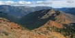
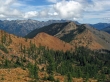
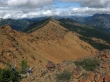
Looking at our route back over to Bootjack Mtn... with the Chiwaukum Mtns and Icicle Ridge beyond.
|
