Switzerland - Schwarzhorn - 9.5.2009
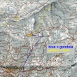
Ride the gondola from Grindelwald to First (2166m)... then follow the signs for Schwarzhorn (2928m)... ~8 miles roundtrip, gaining 3038 feet of elevation.
|
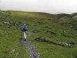
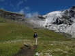
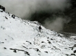
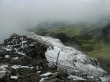
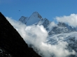
Denali Girl on the trail to Schwarzhorn... looks like marginal weather conditions.
|
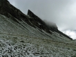
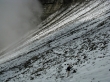
A dusting of snow from last night will make this one a little tricky.
|
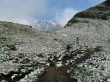
Denali Girl continues towards Schwarzhorn in the distance.
|
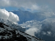
The weather has improved and looks promising.
|
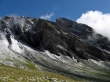
Passing by Gemschberg.
|
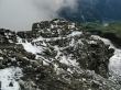
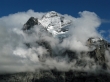
Schwarzhorn is in the middle of the photo... Gemschberg in the right foreground.
|
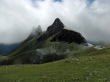
Passing by some interesting horns.
|
Gemschberg.
|
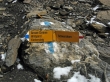
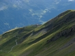
Climbers go left to Schwarzhorn... and hikers to the right.
|
We took the hikers route and are looking at the climbers route... note the ladders on the two steps along the ridge.
|
A closeup of the climbers route... showing the two ladders.
|
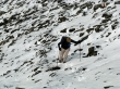
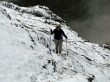
Denali Girl on the hikers route... it is slippery.
|
Looking over at the climbers route... clouds are forming.
|
Denali Girl getting higher on the hikers route.
|
Clouds chasing Denali Girl up the hikers route.
|
Denali Girl still climbing on Schwarzhorn.
|
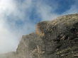
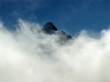
Clouds are now on the summit.
|
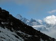
Looking across the valley we can see the summit of Schreckhorn.
|
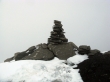
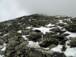
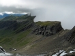
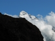
Schwarzhorn summit carin... very limited visibility.
|
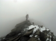
Another hiker is coming over to the summit.
|
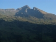
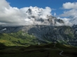
Wish we had this kind of weather today... the photo was taken a few days later... Schwarzhorn is the highest point... with Gemschberg on the right.
|
On the way down now... visibility seems to be improving down lower.
|
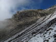
Still ugly looking back at the summit area.
|
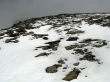
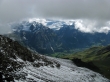
We can see Grindelwald in the valley... very slow going... took longer to get down the snowy area than it did to go up.
|
Looking across the valley to the gorge that separates Schreckhorn and Eiger.
|
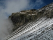
Clouds still hanging on the climbers route to Schwarzhorn.
|
Schreckhorn (4078m) in the distance on the left... the pyramid furtherest away is Finsteraarhorn (4274m)... the highest mountain in the Bernese Alps.
|
Gross Fiescherhorn across the valley.
|
First.
|
|
Pano shot of Schreckhorn and Gross Fiescherhorn across the valley.
|
Schreckhorn.
|
Wetterhorn summit area.
|
Wetterhorn.
|
Wetterhorn.
|
