Grindstone Mtn - 9.24.2009
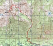
rodman's GPS route of our trip... we rode our bikes 1.5 miles from the Doctor Creek washout on the Icicle Creek road to the Chatter Creek trailhead.
|
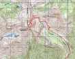
A closer GPS look at the summit area of our trip... the hiking portion of the trip was 10.5 miles, gaining 5308 feet of elevation... toss in 3 miles of bike riding with minimal elevation gain.
|
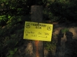
From the Icicle Creek road this sign points to the turn for the Chatter Creek trailhead... and it is a very small sign.
|
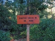
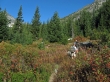
A nice trailhead sign for the Chatter Creek Trail (~2600')... however, it is not visible from the Icicle Creek road.
|
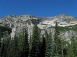
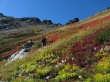
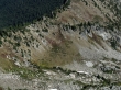
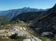
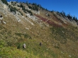
After gaining 2400 feet of elevation in ~2.5 miles, we enter the Chatter Creek basin at 5000 feet.
|
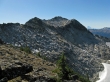
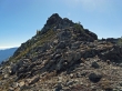
The east side of Grindstone Mtn... the true summit is on the left side of the photo and may not be visible... the bump on the right is at 7460+.
|
Pano showing our general route to the ridge (7400') on Grindstone... from the ridge we dropped down 200 feet on the other side.
|
7460+ on the left and Point 7112 on the right.
|
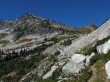
Point 7112 in the center... we are still on the trail.
|
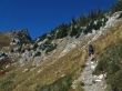
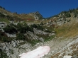
madman nearing the next to last switchback up to the pass... Point 7112 on the left.
|
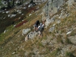
At the next to last switchback madman and rodman left the trail and are heading for the ridge just below 7460+.
|
madman on fire!
|
rodman working his way up to the ridge on Grindstone... Big Jim Mtn in the distance on the right.
|
We've reached the ridge at 7400' and see that there is still some work left to get over to the Grindstone summit... Mt. Rainier in the distance on the right.
|
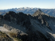
Mt. Daniel and Mt. Hinman.
|
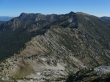
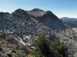
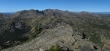
Big Jim Mtn and Big Lou Mtn... the trail is 800 feet below in the lower left of the photo.
|
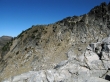
A closeup showing the next to last switchback where we left the trail to come up to the ridge.
|
We are just to the north of 7460+.
|
We looked for a route on the east side of 7460+... but it didn't take very long to realize that there wasn't one for our skill set... so we will backtrack to the ridge at 7400'.
|
Now we can see the route we will use to get to the Grindstone summit... we saw it earlier, but didn't want to give back 200 feet of elevation unless we had to.
|
Looking back at the 200 feet of elevation that we gave up on the west side of Grindstone.
|
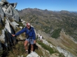
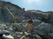
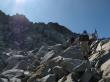
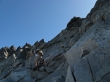
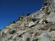
madman is leading the way and looking for the best route.
|
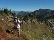
madman and rodman on the way to the Grindstone summit.
|
Getting closer to our target.
|
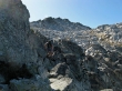
Really getting closer to our target.
|
Not much left to go now.
|
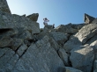
rodman finishes off the last few feet to the summit.
|
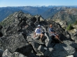
rodman and madman on the Grindstone summit (7533').
|
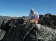
rodman checking out the Grindstone summit register.
|
nwhikers JimK and Randy have been here.
|
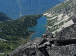
Sylvester Lake from the Grindstone summit.
|
Life is good...
|
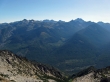
Cashmere, Eightmile and Hi-Jack in the foreground... with the Stuart range beyond... Ingalls Peak in the distance on the far right.
|
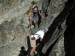
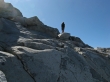
A little bit of Class 3 climbing on our return route... which could have probably been avoided if we had been willing to give up more elevation.
|
rodman climbing back up to the ridge at 7400'.
|
Cape Horn is the pyramid in the foreground... Ladies Peak, Snowgrass Mtn and others beyond.
|
Cashmere Mtn on our way back down to the trail.
|
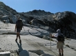
rodman and madman are almost back on the trail.
|
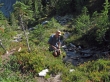
Refilling the water bottles... 3.5 miles of hiking left to get back to the trailhead.
|
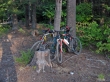
Always nice to see the bikes where we left them in the morning... a 1.5 mile bike ride will get us back to the car.
|
