Axis Peak - 10.8.2009
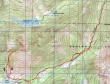
rodman's GPS route of our trip to Axis Peak... 11.2 miles roundtrip, gaining 4297 feet of elevation.
|
Find the Stuart Lake trailhead by driving the Icicle Creek road for 8.5 miles... turn left on FS 7601 and drive 4 miles to the trailhead at end of the road (3400').
|
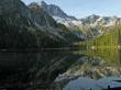
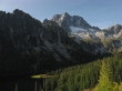
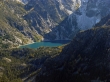
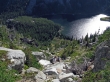
At 4.5 miles we reached Stuart Lake (5064')... with reflections of Mountaineer Ridge, Mt. Stuart and Jack Ridge.
|
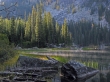
Steam on Stuart Lake.
|

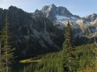
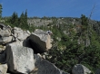
rodman above Stuart Lake... we left the lake at the only boulder field that reaches the lake from Axis Peak.
|
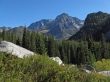
Mountaineer Ridge, Mt. Stuart and part of Jack Ridge as we gain elevation above Stuart Lake.
|

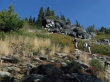
larman and rodman on steep terrain.
|
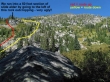
Still gaining elevation... with a full view of the peninsula at the west end of Stuart Lake.
|
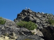
larman and rodman near a rock outcropping at 5600 feet... where we will make a mistake by going to the left and having to deal with a nasty 50 foot section of Slide Alder.
|
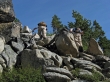
larman and rodman are still on steep terrain.
|
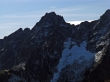
We still can't see the summit... but it is up there somewhere.
|
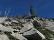
Continuing up on steep terrain.
|
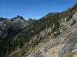
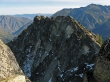
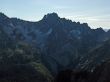
Looking west across Jack Ridge... giving a better perspective of the steepness of the terrain.
|
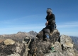
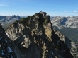
rodman and larman on the Axis Peak summit (7550').
|
ragman on the Axis Peak summit... with Cashmere Mtn in the distance.
|
The north side of Axis Peak.
|
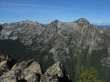
Looking across Mountaineer Ridge to Sherpa Peak and Mt. Stuart.
|
A pano shot of the Stuart Range and Jack Ridge.
|
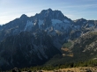
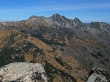
Looking down on Eightmile Lake... with Cashmere Mtn above.
|
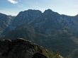
Hi-Jack Peak (Pt. 7828 on Jack Ridge) on the left and Eightmile Mtn on the right.
|
A closeup of Cashmere Mtn.
|
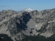
A closeup... looking across Jack Ridge to Mt. Daniel.
|
A closeup of Aasgard Pass, Dragontail Peak and Colchuck Peak.
|
A closeup of Argonaut Peak.
|
A closeup of Sherpa Peak.
|
I scrambled over to the first bump east of the summit and got this shot of larman and rodman on the Axis Peak summit.
|
A closeup of Colchuck Lake and the lower part of the route to Aasgard Pass.
|
rodman and larman in the gully we used to get back down to Stuart Lake.
|
Dragontail Peak and Colchuck Peak... we are almost back to Stuart Lake.
|
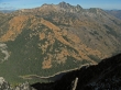
From Stuart Lake this was our route up to and down from Axis Peak... if we do it again, we will use the down route going up and coming down.
|
