Earl Peak - 11.1.2009
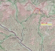
From 29 Pines Campground... drive ~4 miles on the N. Fork Teanaway road... turn right just before crossing Beverly Creek and drive to the trailhead (3600') at end of the road.
|
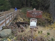
Start hiking on Beverly Turnpike Trail #1391.
|
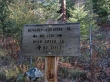
After hiking a half mile, turn right on Bean Creek Trail #1391.1.
|
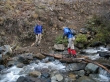
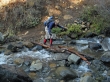
larman watches Denali Girl making the first crossing of Bean Creek.
|
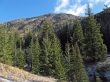
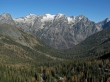
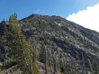
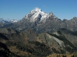
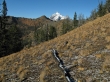
Our first good look at Earl Peak.
|
Denali Girl at the second crossing of Bean Creek.
|
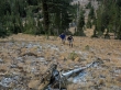
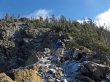
larman and Denali Girl are off-trail and heading for the ridge between Bean Peak and Earl Peak.
|
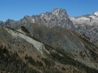
A pano shot of Bean Peak and the Stuart Range... taken from the ridge (6400') between Bean and Earl.
|
A closeup... looking across Volcanic Neck to Mt. Stuart and Sherpa Peak.
|
A closeup of Argonaut Peak, Colchuck Peak, Dragontail Peak and Little Annapurna.
|
A closeup of Argonaut Peak.
|
A closeup of McClellan Peak... with Prusik Peak through the gap on the left.
|
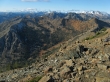
Bean Creek Basin... surrounded by Judy Peak, Mary Peak and Bean Peak.
|
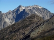
We still have 600 feet of elevation gain to reach the Earl Peak summit on the right.
|
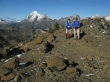
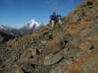
larman heading along the ridge for Earl Peak.
|
Denali Girl takes a break along the ridge between Bean and Earl.
|
Denali Girl getting higher on the ridge between Bean and Earl.
|
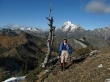
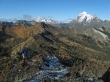
Snow covered Peaks left of the snag are Fortune Peak and Ingalls Peak... Mt. Stuart and Sherpa Peak are right of the snag.
|
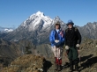
Denali Girl and larman are near the Earl Peak summit.
|
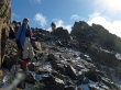
Still need to get beyond the rock formation on the right.
|
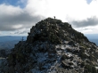
larman on the Earl Peak summit (7036').
|
Denali Girl and ragman on the Earl Peak summit.
|
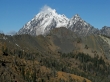
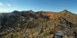
The Stuart Range from Earl Peak.
|
Navaho Peak and Three Brothers from Earl Peak.
|
Bean Peak in the foreground... Bill Peak in the left foreground... Fortune Peak and Ingalls Peak are snow covered... and on the right, looking across Stuart Pass to Fish Eagle (Solomon) Peak, The Cradle and Harding Mtn.
|
A closeup of Mt. Stuart and Sherpa Peak from Earl Peak.
|
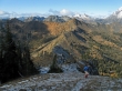
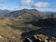
Looking down on Bean Creek Basin... Snoqualmie Pass and Dutch Miller peaks are left and center in the distance... Fortune and Ingalls on the right.
|
larman and Denali Girl on the way down from Earl Peak.
|
Looking across Bean Peak to Mt. Stuart and Sherpa Peak... taken from the pass that separates the Bean Creek and Standup Creek drainages.
|
Denali Girl recrossing Bean Creek... leaving ~.75 miles to get back to the car.
|
