Bearjack West - 1.21.2010
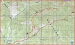
rodman's GPS route of our snowshoe trip to Bearjack West Peak... 11.5 miles roundtrip, gaining 2403 feet of elevation.
|
We thought this would be a very easy ridge walk... however, the ridge had a lot more ups and downs than we could see on our map.
|
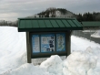
Park on the west side of the N. Fork Teanaway Road... just beyond the Jack Creek Acclimation Site (2600') and just short of 29 Pines Campground.
|
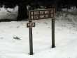
Start walking on FS9738... across the road from the Jack Creek Acclimation Site.
|
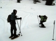
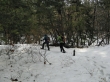
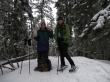
After walking FS9738 for ~1 mile (2760'), we put on our snowshoes...
|
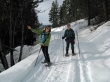
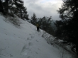
and headed up on easy terrain... most of our steps broke thru 4 to 8 inches of snow.
|
The toughest challenge from the road to the ridge was finding a good path around the exposed brush.
|
At ~3440 feet we found a logging road that was not on our map... and we will use it to get over to a partially-logged rib that will take us to Bearjack ridge.
|
Pano shot looking SE to SW.
|
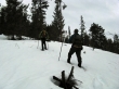
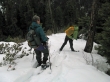
rodman and BarbE start up the partially-logged rib.
|
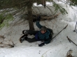
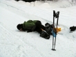
We've reached Bearjack Ridge (3800')... and this is what happens when you step on one of your snowshoes.
|
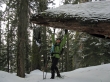
BarbE holding up a tree so that rodman and I can cross under it.
|
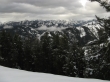
A lot of the Teanaway Peaks from Bearjack Ridge.
|
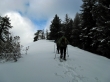
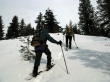
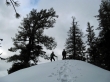
rodman and BarbE near one of the many bumps along Bearjack Ridge.
|
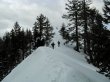
BarbE and rodman on one of the ridge bumps (~4400') we crossed over... still more than 1.5 miles to Bearjack West Peak.
|
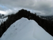
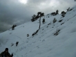
The ridge line narrows as we get close to the west end of a large rock out-cropping.
|
Crossing under the west end of the large rock out-cropping.
|
The east end of the rock out-cropping is more narrow than the west end... what to do now?
|
Giving back some elevation to get past the east end of the rock out-cropping.
|
After 5.5 hours of hiking and snowshoeing... rodman and BarbE stand on the treed summit of Bearjack West Peak (4600+).
|
Continuing east along Bearjack Ridge... looking for a rib that will take us down to FS9738.
|
BarbE does some tree inspection as we head down a rib that will take us to the road.
|

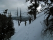
The snow on the rib was the deepest we had seen all day long.
|
BarbE... very happy to be back on FS9738.
|
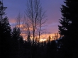
A beautiful sunset... still 2.5 miles of road walking to get back to the car... an 8.5 hour snowshoe trip.
|
