Horse Lake Mountain - 2.20.2010
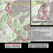
This is not a GPS route... from West Wenatchee drive the No. 2 Canyon Road for ~4 miles and park at the end of the paved road (~2600').
|
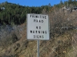
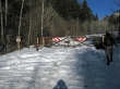
We parked where the pavement ended on No. 2 Canyon Road...
|
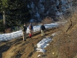
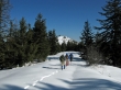
and started walking on the dirt road.
|
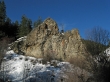
Interesting rock formations along the No. 2 Canyon Road.
|
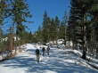
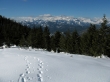
After hiking for a half-mile we came to the permanent gate closure at 2947 feet.
|
Continuing beyond the gate on No. 2 Canyon Road.
|
Jannu set the pace for us all day long... as we switchback along the No. 2 Canyon Road.
|
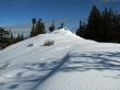
Taking a break before we leave the road (~4200') and head for the ridge line on the left.
|
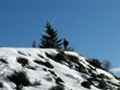
Denali Girl, Jannu and rocman on the south ridge of Horse Lake Mtn.
|
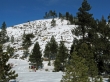
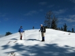
We can see the Horse Lake Mtn summit.
|
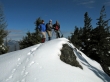
Denali Girl, rocman and Jannu on the Horse Lake Mtn summit (4621').
|
Miller Peak, Earl Peak and Three Brothers.
|
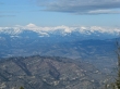
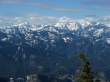
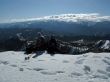
Glacier Peak on the left.
|
Heading over to the NE summit of Horse Lake Mtn.
|
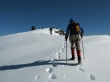
Jannu is very close to the NE summit... rocman and Denali Girl are getting close.
|
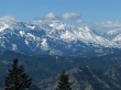
Looking back at Three Brothers and the Stuart Range.
|
Pano shot of Miller, Three Brothers and the Stuart Range.
|
rocman and Jannu on the NE summit... with Mission Peak beyond.
|
Looking beyond Wedge Mtn to Cashmere Mtn.
|
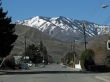
Horse Lake Mtn from Bryan Street in West Wenatchee.
|
