Mountaineer Ridge (6920+) - 6.28.2010
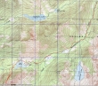
rodman's GPS route of our climb to Mountaineer Peak (6920+)... 12.5 miles roundtrip, gaining 3767 feet of elevation.
|
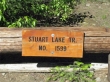
Start at the Lake Stuart Trailhead (3540').
|
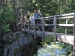
rodman, madman and Sahale at the first crossing of Mountaineer Creek.
|
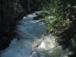
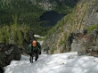
Mountaineer Creek was running hard!
|
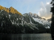
Hiking through a meadow on the way to Lake Stuart... Argonaut Peak on the left... Mountaineer Ridge on the right in front of Sherpa Peak and Mt. Stuart.
|
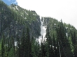
From Lake Stuart... the two gullies in the center of the photo that lead to the Mountaineer Ridge summit look impossible.
|
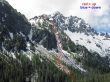
Our route to the summit using the western gully.
|
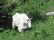
The one-horned goat of Lake Stuart.
|
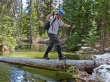
ragman holding his breath at the stream crossing at the west end of Lake Stuart.
|
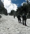
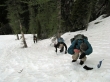
Getting closer to the gully... uh, it still looks steep.
|
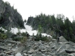
madman, rodman and Sahale at the top of the boulder field and getting ready to put on their crampons.
|
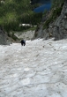
Starting up the gully... it doesn't look as steep as it did from the lake.
|
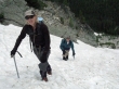
Sahale and rodman climbing up the gully.
|
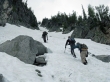
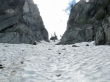
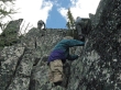
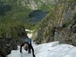
Continuing up the gully... this gully was the crux of the trip.
|
madman, Sahale and rodman near the top of the gully.
|
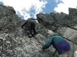
ragman working his way up the gully.
|
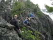
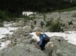
Off the snow and climbing on good rock.
|
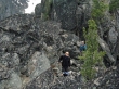
rodman near a cairn.
|
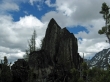
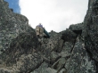
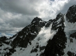
The Mountaineer Ridge summit block... we will give back a little elevation and go around the left side to find an easier route to the summit.
|
Working our way over to the summit block.
|
Starting the final climb to the summit.
|
The final push to the summit (6920+).
|
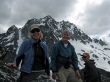
International Team on the Mountaineer Ridge summit... Switzerland, England and the United States.
|
ragman was there also.
|
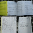
Pages from the summit register.
|
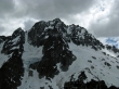
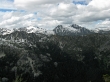
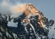
The north face of Mt. Stuart.
|
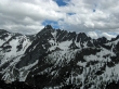
Argonaut Peak from Mountaineer Ridge.
|
Dragontail Peak and Colchuck Peak look like one mountain.
|
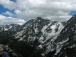
Sherpa Peak from Mountaineer Ridge.
|
Hi-Jack Peak and Eightmile Mountain from Mountaineer Ridge.
|
|
Pano shot of Jack Ridge on the left to Axis Peak on the right.
|
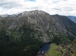
Axis Peak above Lake Stuart.
|
The marshy area at the west end of Lake Stuart.
|
Starting down towards the top of the gully... yes, snow conditions are dictating that we back our way down.
|
madman preparing to back down the gully.
|
No matter what others might say... this gully is very steep.
|
Back to the top of the boulder field.
|
8:15 p.m. at the west end of Lake Stuart.
|
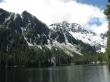
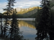
Mountaineer Ridge and Mt. Stuart from the east end of Lake Stuart.
|
madman's shot of Mt. Stuart from the lake... it's 8:30 p.m. and we have 4.5 miles of hiking to reach the car... the last hour was done with headlamps.
|
