Bromaghin Peak and Titus Peak - 7.23.2010
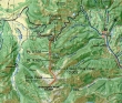
Our approximate route to Titus Peak and Bromaghin Peak... starting from Galena Summit (8701') on Idaho Hwy 75... 29 highway miles NW of Ketchum.
|
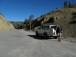
Denali Girl at Galena Summit... note that the sign has been removed (probably stolen)... find the unofficial trail ~150 feet on the west side of the pass.
|
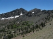
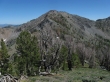
After a short distance we can see Point 9636 and Point 9921.
|
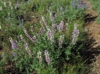
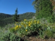
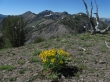
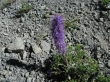
Purple and White Lupine.
|
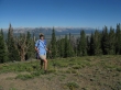
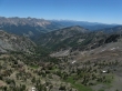
Denali Girl near Point 9636... with the Sawtooth Range and Sawtooth Valley beyond.
|
|
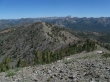
From Point 9636... Sawtooth Range (left), Sawtooth Valley, Boulder Range and White Cloud Range on the right.
|
Our next stop along the ridge will be Point 9921.
|
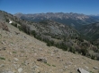
As we gain elevation we get a better view of the Sawtooth Range and Sawtooth Valley.
|
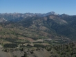
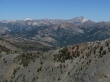
Looking across the Boulder Range to the White Cloud Range... Castle Peak is prominent on the right... D. O. Lee Peak is prominent in the distance on the left... below, Idaho Hwy 75 winds its way up to Galena Summit from Ketchum.
|
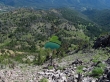
Looking down on Titus Lake from Point 9921.
|
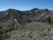
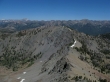
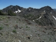
On Point 9921 now... we will follow the ridge to Lower Titus Peak (far right)... then to Titus Peak (far left)... then to Bromaghin Peak (right center).
|
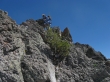
Denali Girl coming down to the saddle between Point 9921 and Lower Titus Peak.
|
Nearing Lower Titus Peak (10,005').
|
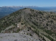
On Lower Titus Peak now... looking back across Point 9921 to the Boulder Range and White Cloud Range.
|
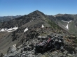
From Lower Titus Peak... Titus Peak on the left and Bromaghin Peak on the right... Saviers Peak in the middle.
|
Bromaghin Peak on the right... as we climb up the NW side of Titus Peak.
|
Looking back at Lower Titus Peak and Point 9921 from Titus Peak.
|
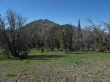
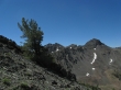
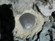
Not sure, but pretty.
|
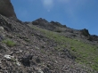
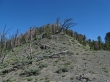
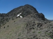
The Titus Peak summit is up there somewhere.
|
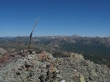
The survey marker on the Titus Peak summit (10,110').
|
The summit register had been damaged by moisture... so I decided to let it dry out while I went over to Bromaghin Peak.
|
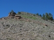
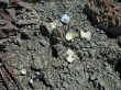
A strange structure on the Titus Peak summit.
|
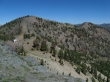
From Titus Peak... Saviers Peak and Bromaghin Peak on the left... Sawtooth Range and Valley in the distance... Lower Titus Peak on the right.
|
A closeup of Bromaghin Peak from Titus Peak... and the ridge route I will use to get over there.
|
On the ridge between Titus Peak and Bromaghin Peak.
|
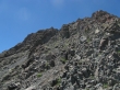
Nearing the Bromaghin Peak summit block.
|
Climbing Bromaghin Peak now... looking across Titus Peak to Castle Peak on the left and Galena Peak on the right.
|
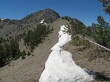
I will use the gully in the center of the photo to reach the Bromaghin summit.
|
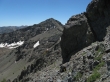
Looking over at Saviers Peak from the base of the gully on Bromaghin Peak.
|
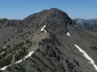
Saviers Peak from the Bromaghin Peak summit (10,225').
|
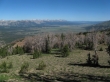
From the Bromaghin summit... looking towards Ketchum and Sun Valley... the Boulder Range on the left... and the Pioneer Range on the horizon in the center of the photo.
|
Looking across Titus Peak to the White Cloud Range on the left and Boulder Range on the right.
|
Sawtooth Range and Sawtooth Valley from Bromaghin Peak.
|
A closeup of D. O. Lee Peak and Castle Peak in the White Cloud Range.
|
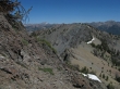
The Boulder Range as I head back to Titus Peak.
|
Saviers Peak from the ridge between Bromaghin Peak and Titus Peak.
|
Back on the Titus Peak summit... Saviers Peak on the left and Bromaghin Peak on the right.
|
Denali Girl waited on me just below the Titus Peak summit... looking across Lower Titus Peak to the Sawtooth Range.
|
Denali Girl on the way down from Titus Peak.
|
Looking back on Titus Peak as we hike back to Lower Titus Peak... the total trip was ~6 miles roundtrip, gaining ~3000 feet of elevation.
|
