Summerland Exploration - 8.13.2010
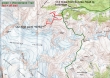
Use the White River entrance to Mt. Rainier National Park... drive ~3 miles to the parking area just beyond the Fryingpan Creek bridge (3800').
|
After hiking ~3.2 miles, cross Fryingpan Creek on a footbridge (5100').
|
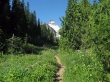
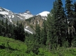
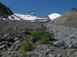
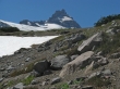
Little Tahoma... a quarter-mile after crossing the footbridge... just before starting the switchbacks up to Summerland.
|
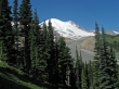
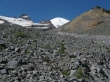
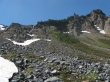
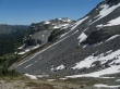
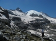
Mt. Rainier from the switchbacks leading up to Summerland.
|
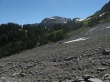
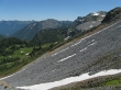
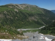
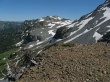
~100 feet below Summerland we left the trail and started traversing west... towards the rock outcropping in the center of the photo.
|
Looking up at Meany Crest as we cross the first creek with no problem.
|
Looking back at Summerland as we head for the second crossing of Fryingpan Creek.
|
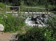
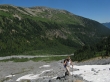
Denali Girl looks for a spot where we can cross Fryingpan Creek.
|
Still trying to find a place to cross Fryingpan Creek.
|
We couldn't find a safe place to cross Fryingpan Creek... so lets head for the prominent point on the right.
|
Denali Girl ascending... with Goat Island Mtn beyond.
|
Meany Crest above... but we are heading to the right.
|
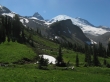
Looking back on Summerland (green)... Crystal Mtn on the left skyline... Tamanos Mtn in the center of the photo... with Govenors Ridge just to the right of Tamanos.
|
Denali Girl on rock... still gaining elevation... Goat Island Mtn beyond.
|
Nearing our high point... we can tell that the views are going to be good.
|
Banshee Peak in the center of the photo.
|
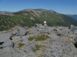
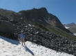
Denali Girl arrives at our high point (~6760').
|
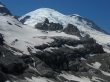
ragman with Little Tahoma, Rainier and K Spire.
|
A closeup of K Spire... with Rainier behind.
|
Banshee Peak from our high point.
|
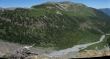
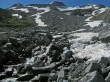
A pano shot of Goat Island Mtn... with Fryingpan Creek roaring below.
|
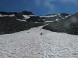
Denali Girl using the snow on her way down from our highpoint.
|
Heading back to Summerland... with our highpoint beyond.
|
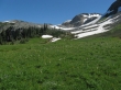
Summerland.
|
Our highpoint from Summerland... 4.2 miles of good trail left to get back to the car... the trip was ~10 miles roundtrip, gaining ~3000 feet of elevation.
|
