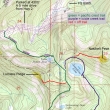
Josephine Lake - 9.3.2010
|
Drive several miles east of Stevens Pass and turn right onto FS 6960 (Mill Creek and the Stevens Pass Nordic Center)... then we drove 5 miles on FS6960 and parked (4300') next to the road.
|
We parked at 4300'... but the road really starts to deteriorate at ~4100 feet... there were two high clearance vehicles parked up higher.
|
Denali Girl starts the half-mile road walk up to the Pacific Crest Trail.
|
The PCT trail marker (4700') on FS 6960.
|
On the PCT now and looking over at Big Chief Mtn and the backside of the Stevens Pass Ski Area.
|
|
Lake Susan Jane (4595')... taken from the switchbacks leading to Josephine Lake.
|
After ~2 miles of hiking we arrive at the trail intersection (5000') of the PCT and Icicle Creek Trail.
|
We left the Icicle Creek Trail near this tarn and started bushwhacking towards the saddle between Nasikelt Peak and Point 5463... Lumiere Ridge is in the distance.
|
There were peek-a-boo looks at Josephine Lake as we bushwhacked towards Nasikelt Peak.
|
Big Chief Mtn in the left foreground... Glacier Peak on the horizon.
|
|
We got cliffed-out about two hundred feet below the summit of Nasikelt Peak in the distance.
|
On the PCT again and heading for Lumiere Ridge... Josephine Lake below... with the Chiwaukum Mountains beyond.
|
A pretty stream along our route towards Lumiere Ridge.
|
Looking at Nasikelt Peak as we head for Lumiere Ridge.
|
Looking at Lumiere Ridge... I'm going to go up the boulder field and look for a path on the ridge.
|
|
Denali Girl is coming up to join me below Lumiere Ridge... Nasikelt Peak and the Chiwaukum Mountains beyond.
|
Ugh... there isn't a path leading to the top of Lumiere Ridge... and after climbing ~150 feet along the ridge, the dense brush turned me away.
|
Looking back on Lumiere Ridge as we head back down to the PCT.
|
Josephine Lake and Nasikelt Peak from the PCT.
|
Lake Susan Jane as we head back to the car... ~6.5 miles roundtrip, gaining ~2000 feet of elevation.
|


