Grand Wash, Cassidy Arch, Cohab Canyon - 9.16.2010
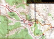
1.9 miles east of the Visitor Center we secured a bicycle at the Hickman Bridge trailhead... then drove 2.5 miles and parked at the Grand Wash trailhead.
|
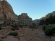
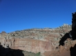
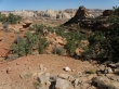
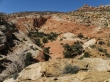
Grand Wash is a canyon that cuts through the Waterpocket Fold... connecting Hwy 24 and the Scenic Drive.
|
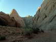
Denali Girl hiking in Grand Wash... there is no elevation gain in Grand Wash.
|
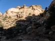
This is as narrow as Grand Wash gets.
|
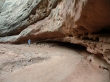
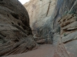
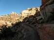
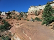
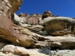
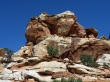
At every turn in the canyon water has undercut the canyon walls.
|
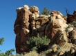
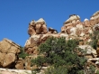
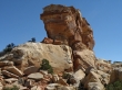
Canyon wall in Grand Wash.
|
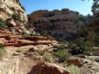
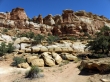
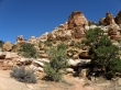
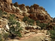
In Grand Wash.
|
In Grand Wash.
|
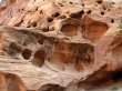
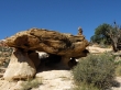
Solution cavities in Grand Wash.
|
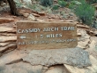
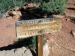
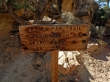
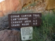
After 2.25 miles of hiking in Grand Wash we reach the Cassidy Arch Trail... the sign is wrong about the arch being at 6350'... 6000' is more accurate.
|
Gaining elevation now... leaving Grand Wash and heading for Cassidy Arch.
|
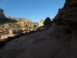
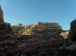
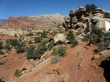
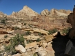
On the Cassidy Arch Trail.
|
On the Cassidy Arch Trail.
|
On the Cassidy Arch Trail.
|
On the Cassidy Arch Trail.
|
On the Cassidy Arch Trail.
|
On the Cassidy Arch Trail.
|
On the Cassidy Arch Trail.
|
Denali Girl on the Cassidy Arch Trail.
|
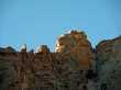
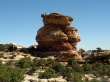
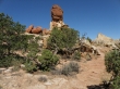
Cassidy Arch is in the distance... below the tree branch reaching to the left.
|
A closeup of Cassidy Arch.
|
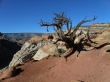
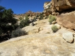
The last half mile over to the arch is on slickrock... with plenty of cairns showing the easiest route.
|
Near Cassidy Arch.
|
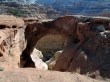
Cassidy Arch.
|
Near Cassidy Arch.
|
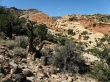
After we visited the arch, we hiked the half-mile back to the main trail and started hiking on the Frying Pan trail which connects the Cassidy Arch trail and the Cohab Canyon trail.
|
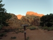
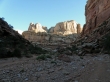
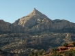
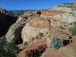
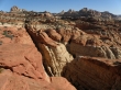
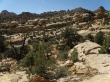
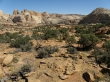
Close to our high point of ~6400... broader views now.
|
Pano shot from our high point along the Frying Pan Trail.
|
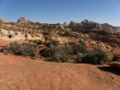
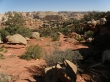
Looking north as we hike along the Frying Pan Trail towards Cohab Canyon.
|
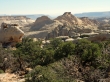
Looking east as we hike along the Frying Pan Trail towards Cohab Canyon.
|
Looking north as we hike along the Frying Pan Trail towards Cohab Canyon.
|
Denali Girl on the Frying Pan Trail.
|
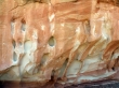
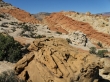
Solution cavities along the Frying Pan Trail.
|
Looking north as we hike along the Frying Pan Trail towards Cohab Canyon.
|
Looking north as we hike along the Frying Pan Trail towards Cohab Canyon.
|
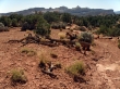
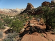
On the Frying Pan Trail.
|
On the Frying Pan Trail.
|
On the Frying Pan Trail.
|
On the Frying Pan Trail.
|
On the Frying Pan Trail.
|
On the Frying Pan Trail.
|
On the Frying Pan Trail.
|
On the Frying Pan Trail.
|
On the Frying Pan Trail.
|
On the Frying Pan Trail.
|
On the Frying Pan Trail.
|
On the Frying Pan Trail.
|
Pano shot looking north... just before we descend into Cohab Canyon.
|
Heading towards Cohab Canyon.
|
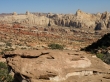
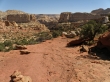
Descending into Cohab Canyon.
|
Descending into Cohab Canyon.
|
Descending into Cohab Canyon.
|
Hwy 24 is only 1 mile away.
|
Descending into Cohab Canyon.
|
We've reached Hwy 24... now I will ride the bicycle 2.5 miles to get the car... this through hike was ~8 miles, gaining ~1400 feet of elevation.
|
