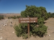
Cathedral Valley - 9.19.2010
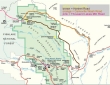
Drive east on Hwy 24 from the Visitor Center for 11.7 miles to milepost 91... the full loop using Hartnet Road and Caineville Wash Road is ~55 miles and will take 7 to 8 hours to complete.
|
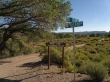
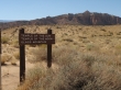
At Milepost 91 look for these signs... follow the dirt road to the Fremont River... staying on the most traveled path when you come to intersections.
|
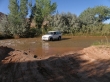
Fording the Fremont River... a high-clearance vehicle is recommended... and be sure to stop at the Visitor Center to check out the road and river conditions before doing this trip.
|
On Hartnet Road.
|
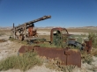
Looks like Dirty Harry might have been in this area.
|
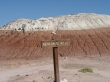
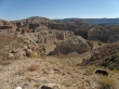
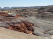
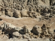
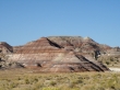
At 8.8 miles the Hartnet Road enters the Bentonite Hills.
|
Bentonite is a general term for clay that is a product of the breakdown of volcanic ash.
|
Virtually nothing grows on bentonite... any seedlings that might take root are usually washed away when it rains.
|
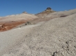
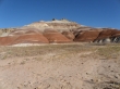
In the Bentonite Hills.
|
In the Bentonite Hills.
|
In the Bentonite Hills.
|
In the Bentonite Hills.
|
In the Bentonite Hills.
|
In the Bentonite Hills.
|
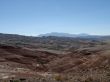
In the Bentonite Hills... with the Henry Mountains in the distance.
|
Shades of brown.
|
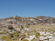
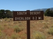
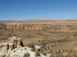
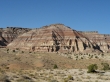
Shortly after leaving the Bentonite Hills we arrived at the Lower South Desert Overlook... which requires a half-mile roundtrip of hiking with very little elevation gain.
|
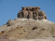
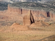
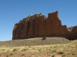
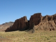
Jailhouse Rock in the Lower South Desert.
|
Looking across this pyramid to part of the Waterpocket Fold.
|
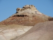
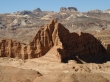
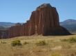
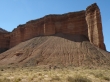
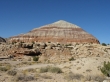
A closeup of The Temple in the Lower South Desert.
|
|
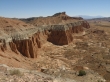
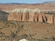
A pano shot of the Lower South Desert.
|
Who are these guys??
|
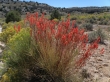
Reminds me of paintbrush.
|
When you reach the Upper South Desert Overlook you have reached the half-way point of the loop.
|
It is only a .4 mile roundtrip hike to the overlook, gaining 80 feet of elevation... and well worth the effort.
|
|
A pano shot of the Upper South Desert.
|
The Cathedral Valley Overlook is a short drive from the Upper South Desert Overlook.
|
A pano shot of Upper Cathedral Valley.
|
A closeup from the overlook of one of the cathedrals in the valley.
|
Upper Cathedral Valley from the overlook.
|
We are now on the Caineville Wash Road in Upper Cathedral Valley.
|
In Upper Cathedral Valley.
|
In Upper Cathedral Valley.
|
Layer Cake Wall... and I did not make up the name.
|
We will take the one mile drive over to these two temples.
|
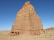
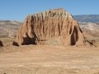
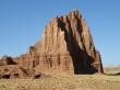
Temple of the Sun.
|
Temple of the Moon.
|
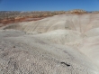
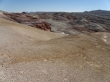
The Bentonite Hills in Lower Cathedral Valley.
|
The Bentonite Hills in Lower Cathedral Valley.
|
The Bentonite Hills in Lower Cathedral Valley... the majority of this trip was driving... we only hiked one mile roundtrip, gaining 120 feet of elevation.
|
