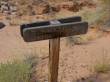
Lower Spring Canyon - 9.20.2010
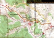
We did this 9.5 mile thru-hike from east to west... leaving a bicycle at the Chimney Rock trailhead... then driving to and parking at a paved turnout near milepost 83 on Hwy 24.
|
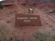
We left a bicycle at the Chimney Rock trailhead... located 3 miles west of the Visitor Center on Hwy 24.
|
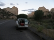
After leaving a bicycle at the Chimney Rock trailhead we parked at this paved turnout near milepost 83 on Hwy 24... then walked east along Hwy 24 for .1 miles and found a cairn on the shoulder of the highway... where we left the highway and bushwhacked a short distance to the Fremont River.
|
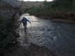
Denali Girl fording the Fremont River... check with the Visitor Center for river conditions before doing this hike.
|
After fording the Fremont River the first quarter mile of hiking is a little brushy.
|
Denali Girl in Lower Spring Canyon.
|
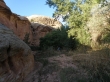
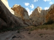
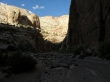
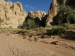
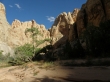
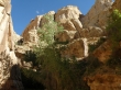
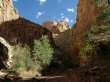
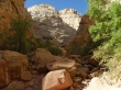
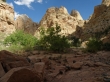
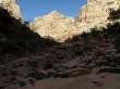
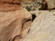
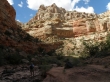
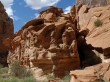
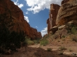
In Lower Spring Canyon.
|
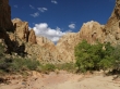
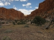
In Lower Spring Canyon.
|
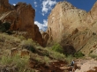
In Lower Spring Canyon.
|
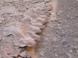
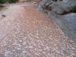
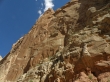
Clay that looks like rock.
|
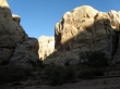
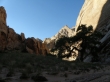
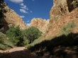
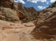
In Lower Spring Canyon.
|
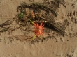
Flower and bug in Lower Spring Canyon.
|
In Lower Spring Canyon.
|
In Lower Spring Canyon.
|
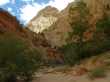
In Lower Spring Canyon.
|
In Lower Spring Canyon.
|
In Lower Spring Canyon.
|
In Lower Spring Canyon.
|
In Lower Spring Canyon.
|
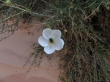
Paintbrush.
|
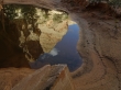
Reflection.
|
In Lower Spring Canyon.
|
In Lower Spring Canyon.
|
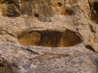
Solution cavities.
|
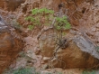
Clay that looks like leaves.
|
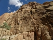
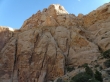
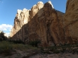
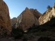
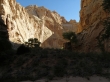
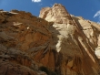
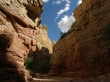
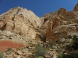
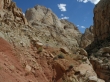
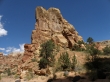
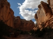
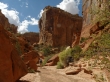
Canyon walls.
|
In Lower Spring Canyon.
|
Doing the best with what you have.
|
In Lower Spring Canyon.
|
Canyon walls.
|
In Lower Spring Canyon.
|
In Lower Spring Canyon.
|
Canyon walls.
|
In Lower Spring Canyon.
|
In Lower Spring Canyon.
|
Denali Girl in Lower Spring Canyon.
|
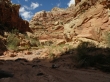
In Lower Spring Canyon.
|
In Lower Spring Canyon.
|
In Lower Spring Canyon.
|
In Lower Spring Canyon.
|
In Lower Spring Canyon.
|
In Lower Spring Canyon.
|
In Lower Spring Canyon.
|
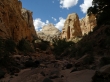
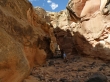
~6 miles into the hike the canyon narrows.
|
Denali Girl at the narrows.
|
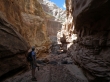
Denali Girl in the narrows of Lower Spring Canyon.
|
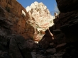
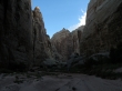
In the narrows of Lower Spring Canyon.
|
We probably could have negotiated this 10 foot dry waterfall... but there is a more difficult 15 foot waterfall just beyond this one... so we will backtrack 150 feet and see if there is a bypass.
|
Denali Girl on the waterfall bypass.
|
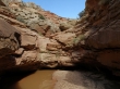
The slot just beyond the dry waterfalls.
|
Denali Girl got past the dry waterfalls.
|
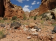
In Lower Spring Canyon.
|
Denali Girl in Lower Spring Canyon.
|
In Lower Spring Canyon.
|
In Lower Spring Canyon.
|
After 6.5 miles of hiking we have reached the confluence of Upper Spring Canyon, Lower Spring Canyon and Chimney Rock Canyon.
|
Only 3 miles left to reach the Chimney Rock trailhead.
|
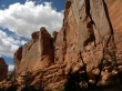
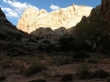
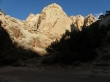
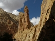
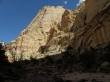
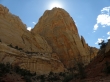
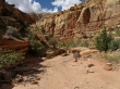
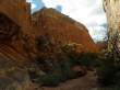
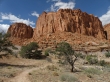
The Wingate Sandstone cliffs in Chimney Rock Canyon.
|
The Wingate Sandstone cliffs in Chimney Rock Canyon.
|
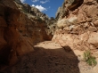
In Chimney Rock Canyon.
|
Denali Girl in Chimney Rock Canyon.
|
In Chimney Rock Canyon.
|
The Wingate Sandstone cliffs in Chimney Rock Canyon.
|
Out in the open now... almost back to the car.
|
Finally on a real trail... a half-mile from the car... this trip was 9.5 miles, gaining 1120 feet of elevation... and I will bicycle 6.5 miles on Hwy 24 to get the car.
|
