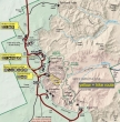
Navajo Loop and Bristlecone Loop - 9.21.2010
|
We drove the 112 miles from Torrey to the park... using Hwy 12 and Hwy 63... the Navajo Loop Trail is only 1.5 miles... and advertised as the biggest bang for your buck in the park.
|
We parked at Sunset Point and made the short walk over to the plateau rim... and got this view.
|
From the plateau rim at Sunset Point.
|
The hike is very popular and quickly loses 550 feet of elevation via a lot of tight switchbacks.
|
Douglas firs reaching for sunshine.
|
|
Hoo-doos and spires everywhere.
|
On the Navajo Loop Trail.
|
On the Navajo Loop Trail.
|
On the Navajo Loop Trail.
|
On the Navajo Loop Trail.
|
|
On the Navajo Loop Trail.
|
On the Navajo Loop Trail.
|
The switchbacks leading back up to the canyon rim.
|
On the Navajo Loop Trail.
|
Back at the plateau rim.
|
|
We drove to Rainbow Point at the southern end of the park and got this shot.
|
From Rainbow Point... looking along the plateau rim.
|
From Rainbow Point we took the one mile Bristlecone Loop hike... and are looking into Corral Hollow.
|
Denali Girl standing next to a Bristlecone Pine.
|
Yovimpa Point on the far right is a short hike off of the Bristlecone Loop Trail.
|
|
Barren.
|
View from Yovimpa Point.
|
On the drive back to the Visitor Center we stopped at Black Birch Canyon overlook and took the 50 foot walk over to the plateau rim.
|
Black Birch Canyon from the plateau rim.
|
Continuing our drive to the Visitor Center we stopped at the Agua Canyon overlook and took the 50 foot walk to the plateau rim.
|
|
Looking south from Agua Canyon.
|
Looking north from Agua Canyon.
|
One last stop on our drive back to the Visitor Center... and a 50 foot walk to the plateau rim.
|
The Natural Bridge from the plateau rim.
|
We saw a herd of Pronghorn just before leaving the park... we hiked a total of 2.5 miles in the park, gaining 665 feet of elevation.
|


