Judy's Peak, Mary's Peak and Bean Peak - 11.3.2010
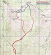
GPS route for Judy's Peak and Mary's Peak... and our general route from Mary's Peak over to Bean Peak... ~8 miles roundtrip, gaining ~3800 feet of elevation.
|
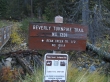
Park at the Beverly Turnpike trailhead (3600').
|
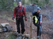
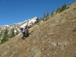
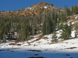
After hiking the Beverly Turnpike Trail for .5 miles, take the Bean Creek Trail... BarbE already looks tired.
|
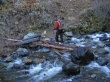
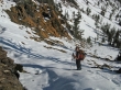
iraman crossing Bean Creek.
|
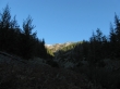
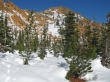
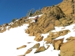
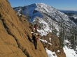
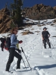
The first avalanche chute... in another .25 miles we will leave the trail (~4600') after the first switchback and head uphill for the east ridge of Judy's Peak.
|
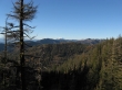
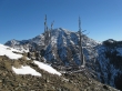
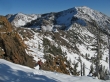
Mt. Rainier comes into view as we gain elevation.
|
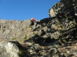
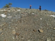
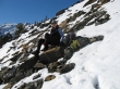
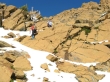
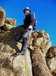
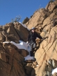
iraman scrambling on a rock outcropping as we head for the east ridge of Judy's Peak.
|
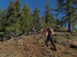
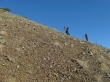
Ever upward.
|
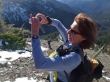
iraman got this shot of BarbE framing a lagging ragman.
|
BarbE and iraman a few hundred feet below the east ridge of Judy's Peak... Judy's Peak in the distance.
|
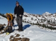
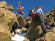
BarbE leans into the hill side while iraman rests.
|
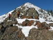
Earl Peak between the goal posts.
|
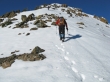
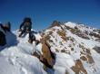
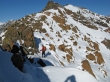
iraman and BarbE are almost on the east ridge of Judy's Peak... sure hope the views of the Stuart Range will be good from there.
|
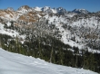
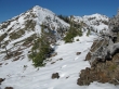
Bean Peak (orange) and part of the Stuart Range from the east ridge of Judy's Peak... Bean Creek Basin below.
|
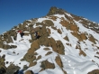
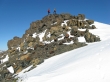
iraman and ragman on the east ridge (~6280') of Judy's Peak... Mt. Stuart in the distance on the right.
|
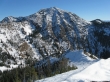
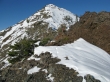
Earl Peak from the east ridge of Judy's Peak.
|
Judy's Peak on the left and Mary's Peak on the right.
|
BarbE heading along the ridge toward Judy's Peak.
|
BarbE and iraman heading for Judy's Peak.
|
BarbE leads the way to Judy's Peak.
|
|
BarbE on the Judy's Peak summit (6560+)... Bill's Peak on the left... Mary's Peak above Barb... Bean Peak on the right... the Stuart Range beyond.
|
Mary's Peak is blocking Mt. Stuart and Sherpa Peak... with Bill's Peak on the left... and Argonaut Peak on the right.
|
BarbE on the ridge between Judy's Peak and Mary's Peak.
|
ragman's better side... with Mary's Peak in the distance.
|
BarbE and iraman on the ridge and heading for Mary's Peak.
|
BarbE and iraman on the ridge and heading for Mary's Peak.
|
Still on the ridge heading for Mary's Peak... the summit is beyond the rock outcropping at the top of the photo.
|
iraman and BarbE nearing the rock outcropping.
|
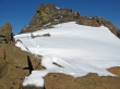
Beyond the rock outcropping now... with clear sailing to the Mary's Peak summit in the distance.
|
iraman and BarbE on the Mary's Peak summit (6680').
|
|
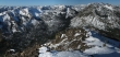
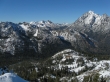
Pano shot of the Stuart Range from Mary's Peak... Bean Peak on the far right.
|
Foreground peaks are Iron (left), Gene's (center) and Bill's (right).
|
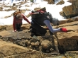
Lunch on Mary's Peak... looking back at Judy's Peak and our route along the ridge.
|
We will give back 600 feet of elevation as we leave Mary's Peak and head for Bean Peak... Earl Peak in the distance.
|
BarbE takes a break below Mary's Peak.
|
Time to start gaining elevation again as we head for Bean Peak.
|
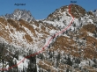
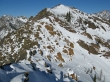
This photo was taken from Judy's Peak and shows our general route to the Bean Peak summit.
|
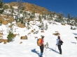
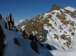
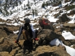
iraman and BarbE looking for the best route to the Bean Peak summit.
|
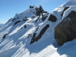
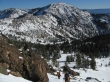
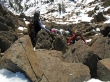
We were tired of breaking through the snow and happy to get on the rock.
|
iraman and BarbE on rock and heading for the summit.
|
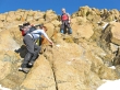
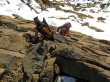
BarbE showing iraman some technique.
|

ragman and BarbE nearing the Bean Peak summit.
|
iraman dancing on the Bean Peak summit... and BarbE is close.
|
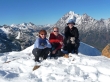
Group shot on the Bean Peak summit (6743').
|
Bill's Peak (far left)... then Fortune and Ingalls... looking through the gap to Harding, Cradle and Nursery... Stuart and Sherpa on the far right.
|
|
Pano shot of the Stuart Range from Bean Peak... Volcanic Neck and Devils Head in the foreground.
|
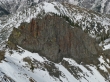
A closeup of Volcanic Neck.
|
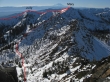
From Bean Peak we are looking at our general route along the ridge to Judy's Peak and Mary's Peak... then down from Mary's and back up to Bean.
|
BarbE and iraman leaving the Bean Peak summit.
|
Continuing down from the Bean Peak summit.
|
Still heading down on good rock.
|
ragman observing.
|
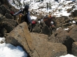
Very steep in this section...
|
but the hand and foot holds were excellent.
|
BarbE and iraman... with Earl Peak in the distance.
|
ragman tagging along.
|
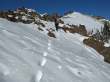
iraman is off of the rock and back on the snow.
|
iraman heading down to Bean Creek Basin.
|
BarbE and ragman on the way down to Bean Creek Basin... Bean Peak above.
|
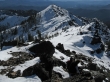
Bean Peak from Bean Creek Basin... ~3 miles to get back to the car.
|
