White Bluffs - North Slope - 4.1.2011
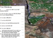
From Ellensburg... drive east on I-90 and cross the Columbia River... take Exit 137 and drive WA-26E for 1 mile... turn right onto WA-243S and drive 14.3 miles... turn left onto Road 24 SW and drive 13.8 miles... turn left onto WA-24E and drive 9.5 miles... then see next map.
|
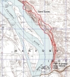
Just beyond Mile Post 63 on WA-24E... turn right, drive thru the fancy gate, and drive 3.9 miles on a gravel road... turn right and drive 1.4 miles... watch for the trail on your right, leading uphill towards the top of the bluffs... park in a grassy area next to the road.
|
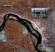
rodman's GPS route of our hike in the White Bluffs area... 8 miles roundtrip, gaining 1078 feet of elevation... part of the GPS route has us walking on water... just for the record, this did not happen.
|
Parking in a grassy area next to the road... look north and you will see the unsigned trail heading uphill towards the top of the bluffs.
|
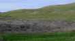
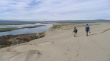
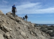
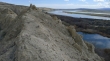
That's the unsigned trail going up to the top of the bluffs... taken from our parking area.
|
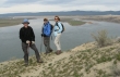
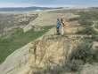
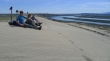
ragman, Denali Girl and BarbE on the White Bluffs.
|
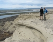
Looking back on the trail we used to get up on top of the bluffs... our car is parked near the group of large trees next to the road.
|
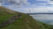
rodman, Denali Girl and ragman hiking north above the White Bluffs.
|
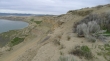
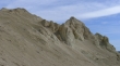
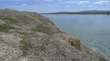
The cliffs are impressive.
|
Looking south.
|
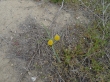
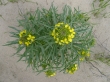
Some flowers, but not a lot yet.
|
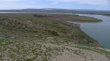
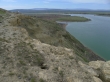
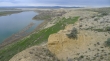
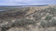
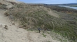
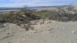
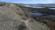
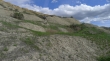
Looking north... interesting terrain below the bluffs.
|
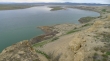
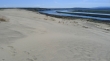
We can see the sand dunes above the cliffs on the left.
|
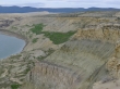
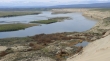
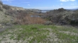
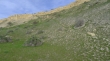
Interesting green plateau on the bluffs... mid-way between the river and top of the bluffs.
|
Relaxing in yet-to-bloom balsamroot.
|
More yellow.
|
Looking south... and down on the green plateau.
|
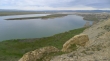
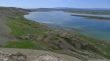
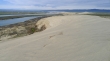
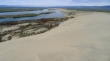
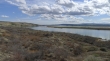
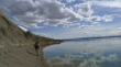
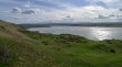
Looking north... Locke Island in the middle of the river.
|
Denali Girl and BarbE tempting fate.
|
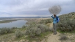
Denali Girl is 'Tumbleweed Queen for the Day'.
|
We will continue along the bluffs... and head for the sand dunes on the right.
|
Looking south.
|
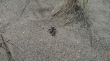
We saw lots of these guys on the hike.
|
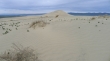
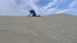
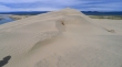
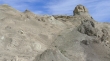
Sand dune in sight.
|
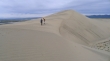
Denali Girl and BarbE nearing the top of the first sand dune.
|
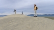
rodman, Denali Girl and BarbE on top of the first sand dune.
|
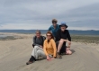
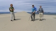
Group shot... rodman, BarbE, Denali Girl and ragman.
|
Looking south from the first sand dune.
|
Looking north from the sand dune... we will head for the big sand dune in the distance.
|

Shadow People were out today.
|
Water.... water...
|
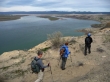
ragman and Denali Girl on the White Bluffs.
|
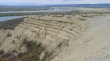
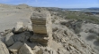
Looking north along the White Bluffs... layers of basalt.
|
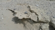
Fragile.
|
Looking north... heading for the dunes on the far right.
|
Uh... we didn't see this coming.
|
BarbE, Denali Girl and rodman heading for the second sand dune.
|
Nearing the top of the second big sand dune.
|
Looking south.
|
Lunch break on top of the second big sand dune.
|
Looking north from the second big sand dune.
|
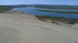
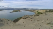
A pano shot from the second sand dune... south (left) to north... Locke Island in the middle of the river.
|
We have decided that we will return via the interesting terrain a few hundred feet below the top of the bluffs.
|
BarbE leads us toward a place that will make it easy to get down below the bluffs.
|
Looking south... down below the bluffs now.
|
Basalt.
|
We are well below the top of the bluffs now.
|
Close to the river... looking north.
|
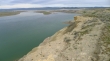
Close to the river... looking south.
|
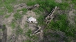
Not everything gets out of here alive.
|
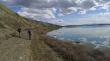
Walking south now... and looking north from above the first pond.
|
Not as dangerous as it might seem.
|
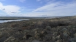
Looking north... lots of ups and downs on the terrain below the top of the bluffs.
|
Looking south.
|
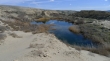
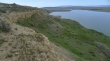
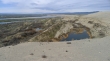
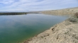
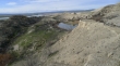
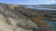
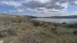
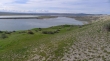
Another pond below the bluffs.
|
Looking south.
|
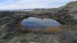
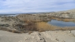
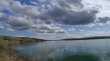
Yet another pond.
|
Looking south.
|
Looking north.
|
Looking south.
|
Looking south.
|
Looking south.
|
Looking north.
|
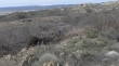
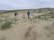
Even though there are pretty good paths, you still need to work through some brush at times.
|
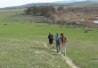
rodman and BarbE heading south.
|
Looking south.
|
We are going to try and return by staying close to the river.
|
The terrain next to the river is getting steeper.
|
rodman finds us a route up from the river... we had to retreat about an eighth of a mile because it got too steep by the river.
|
rodman and BarbE look for the best way to get back up on top of the bluffs.
|
Looking north.
|
Looking south.
|
BarbE and rodman nearing the top of the bluffs.
|
Looking north from the top of the bluffs... almost back to the car now.
|
We can see the car... just to the left of the large trees.
|
