White Bluffs - South Slope - 4.12.2011
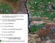
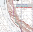
From Ellensburg... drive east on I-90 and cross the Columbia River... take Exit 137 and drive WA-26E for 1 mile... turn right onto WA-243S and drive 14.3 miles... turn left onto Road 24 SW and drive 13.8 miles... turn left onto WA-24E and drive 9.5 miles... then see next map.
|
Just beyond Mile Post 63 on WA-24E... turn right, drive thru the fancy gate, and drive 8.2 miles to the end of the road.
|
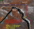
rodman's GPS route of our hike on the south slope of the White Bluffs... 7.5 miles roundtrip, gaining 1190 feet of elevation.
|
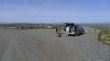
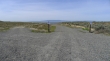
At the end of the 8.2 mile drive there is a nice parking area.
|
Looking north from the parking area towards the north slope of the White Bluffs.
|
From the parking area we took the road on the right and started downhill... the road on the left probably stays high and goes along the top of the bluffs.
|
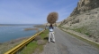
Looking south as we continue down the paved road.
|
Looking north as we continue down the paved road.
|
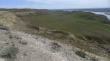
We have left the paved road and hiked over near the river... looking back at the bluffs.
|
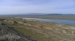
Looking at the bluffs from near the river.
|
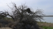
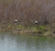
Nesting activity along the river... lots of birds.
|
A fire hit this area a few years ago.
|
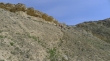
Like the one in this photo, there are lots of trails leading up to the top of the bluffs.
|
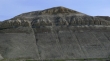
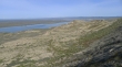
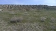
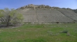
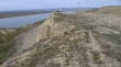
A closeup of the bluffs.
|
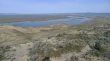
A pano shot of the river and bluffs.
|
Looking south... we will hike back up to the road and continue south for a bit more.
|
Two Canadian Geese.
|
The same two Canadian Geese in flight.
|
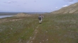
Heading back towards the road and bluffs.
|
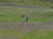
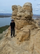
BarbE has found a hat.
|
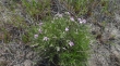
Phlox.
|
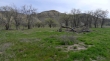
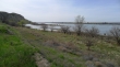
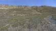
We have left the road again... now we are on the bluff side of the road and have found this broad valley.
|
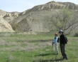
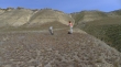
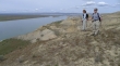
BarbE and rodman crossing the valley and heading for the bluffs.
|
We are looking for a path that will get us up on top of the bluffs.
|
It is hot in the valley... time to remove a layer... our path to the top is on the hillside between rodman and BarbE.
|
BarbE leads the way to the top of the bluffs.
|
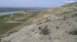
Near the top of the bluffs... looking across the valley to the river.
|
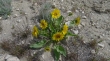
The balsamroot are starting to bloom.
|
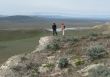
Heading north now... BarbE and rodman on top of the bluffs.
|
ragman and BarbE on top of the bluffs.
|
Looking north from our lunch spot along the top of the bluffs.
|
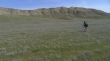
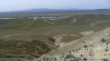
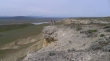
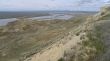
Looking south at the huge valley... from our lunch spot along the top of the bluffs.
|
We have hiked down from the top of the bluffs and heading for some pyramid-shaped objects on the left.
|
BarbE and rodman on the river-side of the road in interesting terrain.
|
Looking north and heading for the pyramid.
|
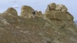
rodman and BarbE exploring what we thought looked like a pyramid from a distance.
|
ragman couldn't find a safe way to the top.
|
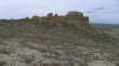
Heading back towards the road now... and looking back at the rock formation.
|
Heading uphill back towards the car... looking north.
|
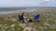
Relaxing near the parking area after completing the hike.
|
