Navaho Peak - 6.12.2011
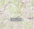
From 29 Pines Campground... drive the N Fork Teanaway River road for 1.2 miles... turn right onto FS 9703 and drive 2.5 miles to the Stafford Creek trailhead (3100').
|
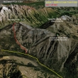
A google earth look at the Navaho Peak area.
|
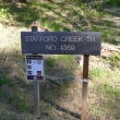
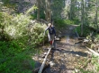
The Stafford Creek Trailhead.
|
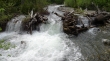
Stafford Creek was roaring.
|
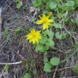
If it isn't balsamroot, it is a nice impersonation.
|
Denali Girl at the first stream crossing.
|
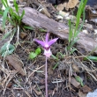
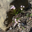
Fairy Slipper orchid
|
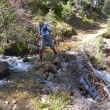
Denali Girl at another stream crossing... there were 4 of them that required more than a simple step-across.
|
At ~4200 feet the trail has been trashed from a slide coming down a gully on the south side of Freedom Peak.
|
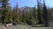
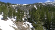
Freedom Peak from a meadow along the Stafford Creek trail.
|
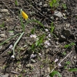
A Yellow Bell... with a sprinkling of Spring Beauties.
|
Spring Beauties dominated the flower scenery on this hike.
|
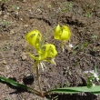
Glacier Lily
|
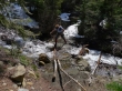
After hiking for 3.5 miles, Denali Girl crosses the stream at ~4800 feet... where we will leave the main trail and head north for the Navaho summit.
|
Off trail now... Freedom Peak (a.k.a Little Navaho) in the distance.
|
On steeper terrain now... the summit is up there somewhere... nice waterfall in the center of the photo.
|
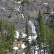
A closer view of the waterfall.
|
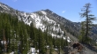
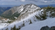
Gaining elevation now... looking over at Freedom Peak (6442')... and we need to get to 7200 feet.
|
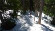
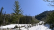
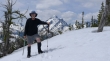
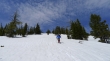
Still going up... and looking for as much shade as we can find.
|
There won't be much shade from here on.
|
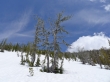
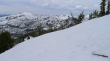
Close to 6400 feet and the same height as Freedom Peak... only 800 more feet of elevation gain to go.
|
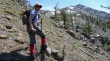
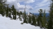
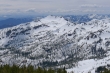
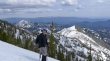
Denali Girl ascending... Earl Peak on the right... with a distant look at Mt. Rainier (center).
|
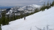
As we get higher, more of the Teanaway Peaks come into view to the right of Earl Peak.
|
ragman, Mt. Stuart and Sherpa Peak.
|
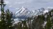
Still ascending... and a clear view of Mt. Stuart, Sherpa Peak and Argonaut Peak.
|
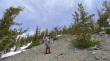
At ~6800 feet we have found a melted out portion of the summer path that leads to the Navaho summit.
|
Really close to the summit now.
|
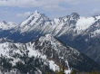
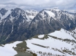
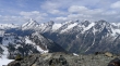
A pano shot from near the summit... the Stuart Range dominates the view.
|
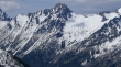
A closer look at Mt. Stuart, Sherpa Peak and Argonaut Peak.
|
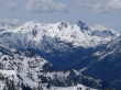
A close look at Dragontail Peak, Little Annapurna, Enchantment Peak (through the gap) and McClellan Peak.
|
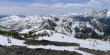
A pano shot from Earl Peak (left) to Argonaut Peak on the right.
|
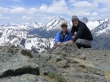
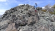
Denali Girl and ragman on the Navaho Peak summit (7223').
|
A closeup of Mt. Stuart and Sherpa Peak.
|
A pano shot of Fortune Peak (far left) to Little Annapurna on the right.
|
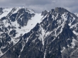
A closeup of Argonaut Peak.
|
A closeup of Dragontail Peak and Little Annapurna... with Witches Tower through the gap.
|
A closeup of Fortune Peak and Ingalls Peak.
|
A pano shot from Earl Peak to Little Annapurna.
|
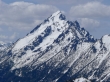
A closeup of Earl Peak.
|
Three Brothers
|
Denali Girl leaving the Navaho Peak summit.
|
Descending
|
ragman descending... Miller Peak on the left and Freedom Peak on the right.
|
Ever downward.
|
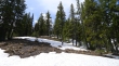
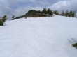
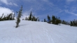
Back to patchy snow... still 400 feet above the trail... roughly 4 miles of hiking to get back to the car... the trip was ~11 miles roundtrip... gaining ~4200 feet of elevation.
|
