K9 - 7.2.2011
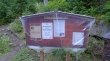
On the west side of Stevens Pass there is a hairpin turn in Hwy 2 just before making the final climb up to the ski area... in this hairpin turn, turn on to FS 6095 and drive ~1.1 miles to the Tunnel Creek trailhead (~3100').
|
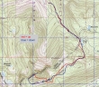
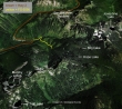
rodman's GPS route of our trip to K9... 10.5 miles roundtrip, gaining 4113 feet of elevation.
|
The last 50 yards of FS 6095 to the Tunnel Creek trailhead is blocked by a couple of down trees.
|
The Tunnel Creek Trail isn't officially open yet.
|
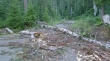
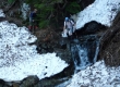
This down tree has taken out part of the trail.
|
After less than a half-mile of hiking we got this look at the north side of K9... we will approach from the other side.
|
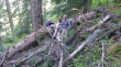
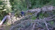
At least a dozen down trees on the Tunnel Creek Trail.
|
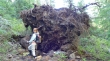
BarbE lends perspective to the second monster tree that has fallen on the trail.
|
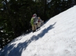
Denali Girl negotiates around this down tree that now covers 75 feet of trail.
|
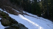
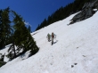
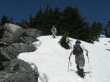
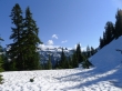
BarbE and rodman on the Tunnel Creek Trail... there was patchy snow at ~3600 feet.
|
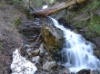
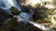
The first stream crossing.
|
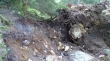
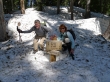
BarbE and rodman at the first stream crossing... where the stream has washed away the trail.
|
BarbE got this shot of Denali Girl and ragman at the second stream crossing.
|
rodman and BarbE at the junction of the Tunnel Creek Trail and the Pacific Crest Trail.
|
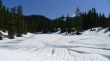
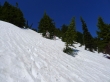
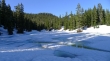
Still 3 to 4 feet of snow at Hope Lake (~4400').
|
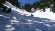
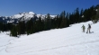
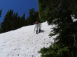
BarbE and rodman doing their best to follow the Pacific Crest Trail south of Hope Lake.
|
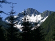
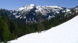
At ~5000 feet we got this view of Thor Mountain and Nimbus Mountain.
|
At ~5200 feet we got a clearer view of Thor Peak and Nimbus Mountain... Slippery Slab Tower at the end of the right ridge line.
|
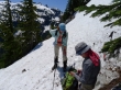
rodman checks his GPS... we are on steep terrain and have strayed above the Pacific Crest Trail.
|
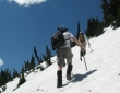
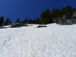
After giving back some elevation, we are making an upward traverse along the south side of K9... heading for K9's west ridge.
|
rodman and BarbE on the south side of K9.
|
ragman and BarbE on the upward traverse towards the west ridge of K9.
|
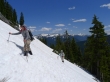
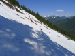
Tired of traversing, BarbE takes a more direct route towards K9's west ridge... steeper than it looks here.
|

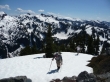
Nearing the summit now... Thor and Nimbus are in the foreground.
|
BarbE and ragman walking next to the boulders on the west ridge of K9.
|
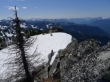
rodman and ragman nearing the summit.
|
BarbE and rodman took a short break while I headed over to the summit.
|
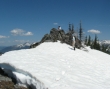
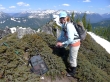
ragman and BarbE on the K9 summit (6242').
|
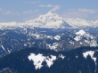
A closeup of Glacier Peak from the K9 summit.
|
BarbE on the K9 summit... the Chiwaukum Mountains are in the distance.
|
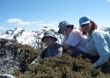
Group shot on the summit of K9.
|
A pano shot looking south from the K9 summit... Thor and Nimbus in the foreground... prominent peaks along the horizon are Stuart, The Cradle, Mt. Daniel and Mt. Hinman.
|
We chose to return via the west ridge of K9.
|
The west ridge is steep in places.
|
Almost back down to the Pacific Crest Trail.
|
Side hilling along the snow-covered crest trail.
|
Last look back at Nimbus Mountain and the Slippery Slab Tower before we drop back down to Hope Lake.
|
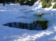
One of the two small ponds just south of Hope Lake.
|
Back to Hope Lake.
|
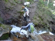
rodman back at the first stream crossing... due to snow melt the stream is flowing harder than earlier in the day... roughly one mile left to get back to the car.
|
