Mount Hunt - 8.11.2011
The third day of our '4 day, 3 night' backpack trip... relocate camp from the N. Fork Granite Canyon to Open Canyon by going over the Mt. Hunt Divide... and include a side trip to the Mt. Hunt summit... total day stats are 8.5 miles, gaining 2500 feet of elevation.
|
Denali Girl leaving camp in the N. Fork Granite Creek.
|
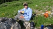
The bugs were bad in camp so we stopped along the trail to eat breakfast.
|
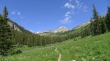
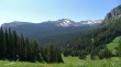
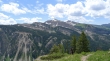
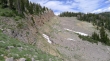
Looking back up the N. Fork Granite Canyon to Point 10,116... Housetop Mtn is in the distance on the left.
|
After a half-mile of hiking we will take the Open Canyon Trail to the Mt. Hunt Divide.
|
On the Open Canyon Trail now... looking across Granite Canyon to Rendezvous Mtn (far left) and Cody Peak (center).
|
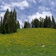
Yellow hillside... made so by Balsamroot.
|
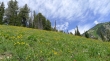
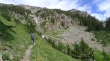
Still ascending on the Open Canyon Trail.
|
Denali Girl nearing the Mt. Hunt Divide.
|
We think the Mt. Hunt Divide is on the far right... however it is a false divide... Mt. Hunt is on the far left.
|
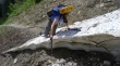
An awkward spot on the trail.
|
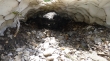
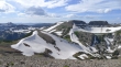
A persistent snow cave.
|
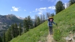
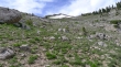
Gaining elevation above Granite Canyon as we head for the Mt. Hunt Divide... Rendezvous Mtn in the distance.
|
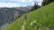
Denali Girl on the Open Canyon Trail.
|
Finally... the Mt. Hunt Divide on the far right... with Mt. Hunt on the far left.
|
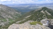
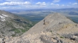
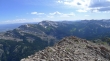
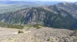
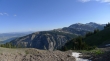
Looking east down Granite Canyon to Jackson Hole in the valley.
|
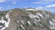
I've left the trail just short of the Mt. Hunt Divide (center) and on my way to the Mt. Hunt summit.
|
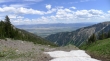
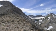
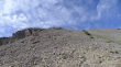
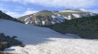
Steeper than it looks... which way to go when I get closer to the summit?... I will go to the right of the snowfield to get quicker views from the ridge.
|
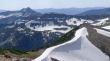
I've reached the ridge... Phelps Lake is at the east end of Open Canyon... the Mt. Hunt Divide is lower right in the photo.
|
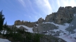
From the ridge... the Mt. Hunt summit is somewhere higher on the left... Point 10,988 on the right.
|
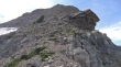
I'm starting to wonder if I picked the wrong side of the snowfield to be on... there will be some Class 3 climbing ahead.
|
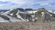
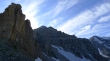
Beyond the Class 3 stuff now... looking over to Coyote Lake (10,201')... Point 10,905 (left), Point 10,800+ (center) and Point 10,988 (right).
|
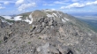
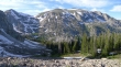
On the Mt. Hunt summit (10,783') now... looking west to Indian Lake below Point 10,440+... with Housetop Mtn in the distance on the left.
|
Looking along Mt. Hunt's east ridge to Phelps Lake and the valley that connects Jackson Hole to Yellowstone National Park.
|
Looking north to the two bumps on Prospectors Mountain... with The Grand in the distance between them.
|
Looking south across Granite Canyon to Rendezvous Mountain on the left.
|
A better look at Coyote Lake on the right.
|
The Mt. Hunt summit cairn.
|
Looking across Granite Canyon... the Snake River snakes its way down the valley.
|
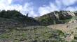
On the way down... I decided to avoid the Class 3 terrain... still steep, but only Class 2.
|
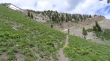
Back to the trail and looking up at the route that I took on the way down... needed to use a couple of veggie belays to get down the cliffy area in the center of the photo.
|
Back on the trail... looking across Granite Canyon to Rendezvous Mountain.
|
Prospectors Mountain from the Mt. Hunt Divide.
|
Mt. Hunt (center) from the Mt. Hunt Divide.
|
Prospectors Mountain (right)... Point 10,988 on the left... Open Canyon below.
|
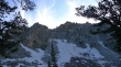
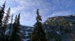
Dropping into Open Canyon now... looking up at the NE side of Mt. Hunt.
|
From Open Canyon... looking up at the Mt. Hunt Divide (far left).
|
Prospectors Mountain (right) from near our campsite.
|
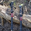
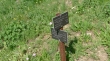
Woke up the next morning to find out what can happen to hiking poles when you just throw them on the ground instead of standing them up against a tree.
|
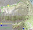
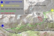
This is the route we will follow back to Teton Village.
|
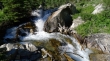
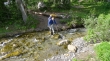
The Open Canyon Creek is running strong.
|
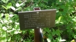
We have reached the Valley Trail and now have 4.3 miles of hiking left to reach Teton Village.
|
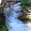
The Open Canyon Creek.
|
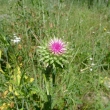
Another thistle?
|
2.4 miles left to reach Teton Village... the day's hike from our camp in Open Canyon to Teton Village was 7 miles with a few hundred feet of elevation gain.
|
