Point 6567 above Dewey Lake - 9.14.2011
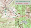
My approximate route to Point 6567 above Dewey Lake... ~5.5 miles roundtrip, gaining ~1500 feet of elevation.
|
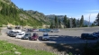
There is a nice parking area on the north side of Chinook Pass.
|
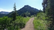
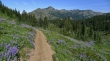
From the parking area I'm on the Pacific Crest Trail heading back up towards Chinook Pass... Naches Peak above.
|
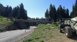
Still working on the hiker's bridge over Hwy 410.
|
I've crossed Hwy 410 and on the beginning of the Naches Peak Loop... looking across 410 to Yakima Peak.
|
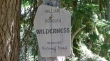
It doesn't take long before you enter the William O. Douglas Wilderness.
|
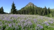
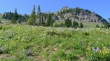
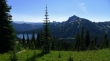
My destination (Point 6567) is in the center of the photo.
|
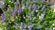
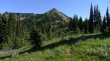
The flower show alone is worth the trip.
|
Looking back across Hwy 410 to where the Pacific Crest Trail crosses Sourdough Gap above Sheep Lake.
|
Looking up to the summit of Naches Peak.
|
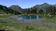
A tarn along the Naches Peak Loop trail.
|
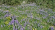
Purple and gold...
|
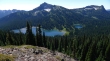
After hiking for two miles I can look down on Dewey Lake... this is where I found a nice boot path leading down toward the lake.
|
After losing ~150 feet of elevation, the boot path levels out and traverses over to the base of Point 6567 (left).
|
Heading toward Point 6567... getting ready to start gaining elevation.
|
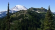
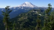
Gaining elevation on Point 6567 now... looking across Naches Peak to Mt. Rainier.
|
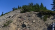
There is some steep terrain on Point 6567, but tread will show you the way... Point 6710 on the right.
|
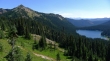
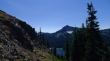
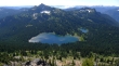
Dewey Lake... Point 6710 (center) and Seymour Peak (right).
|
Still gaining elevation... Cowlitz Chimneys come into view below Rainier on the left.
|
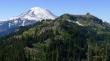
Higher still... Governors Ridge (spires in the center of photo below Rainier)... Burroughs Mountain in the distance on the right.
|
The terrain steepens near the top of Point 6567.
|

The summit of Point 6567... Point 6710 on the right.
|
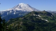
Mt. Rainier from Point 6567.
|
Dewey Lake from Point 6567.
|
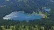
A closeup of Dewey Lake from Point 6567.
|
