Crown Point - 12.9.2011
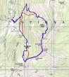
rodman's GPS route from April 2005... the same route BarbE and I did... with the solid red lines showing how we altered the route... ~5 miles roundtrip, gaining 2459 feet of elevation.
|
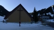
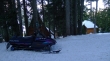
We parked in the Crystal Mountain ski area parking lot (4350') and started uphill from the ski area chapel.
|
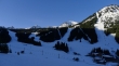
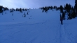
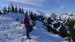
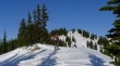
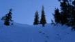
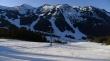
Leaving the ski area and heading east for Bullion Basin.
|
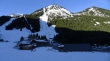
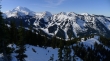
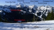
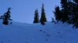
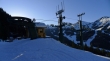
As we gain elevation ski area peaks come into view... left to right... Three Way Peak, Silver King, The Throne and Silver Queen... no idea if the bump on the far right has a name or not.
|
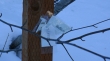
The original trailhead sign is gone... and the temporary sign is not doing well.
|
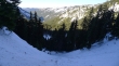
Gaining elevation now on the trail to Bullion Basin... Silver Queen, the Summit House and Grubstake Point.
|
BarbE in Bullion Basin (5800')... looking up at Point 6479... we need to get there for some sunshine.
|
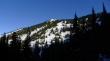
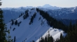
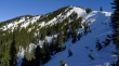
Looking NE from Bullion Basin to East Peak.
|
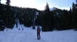
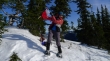
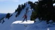
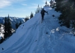
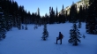
BarbE heading for Point 6479 above Bullion Basin.
|
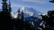
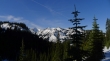
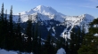
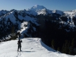
First look at Mount Rainier on the way to Point 6479.
|
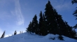
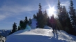
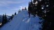
Steep here... but the sunshine is drawing us to Point 6479.
|
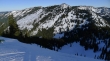
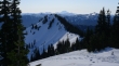
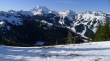
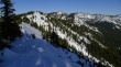
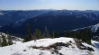
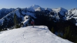
Looking north from Point 6479 down to Bullion Basin and across to East Peak and Norse Peak.
|
BarbE at Point 6479... with Mt. Rainier and the ski area behind.
|
Merry Christmas from BarbE.
|
Mt. Rainier from Point 6479.
|
From Point 6479 we will follow the ridge across Blue Bell Pass to Crown Point... Mt. Adams on the horizon.
|
A closeup of Mt. Rainier and the ski area.
|
Crown Point in the foreground with Mt. Adams in the distance.
|
BarbE on Tanzbodeli (a.k.a the little dance floor).
|
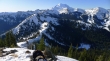
Mt. Rainier and the Crystal Mountain Peaks from Blue Bell Pass... Pickhandle Basin below.
|
Peak identification from the previous photo.
|
BarbE in Blue Bell Pass... on the way to Crown Point... Point 6479 behind.
|
BarbE is glowing near Blue Bell Pass... heading for Crown Point.
|
Looking back at Point 6479 in the left foreground... East Peak and Norse Peak beyond.
|
BarbE nearing Crown Point.
|
ragman nearing Crown Point (6480+).
|
Pickhandle Point in the left foreground... we will follow the sunlit ridge down to Pickhandle Gap... and then drop into Pickhandle Basin (lower right).
|
Looking south from Crown Point... Mt. Adams (center) and Mt. St. Helens (far right) are on the horizon.
|
ragman pauses for a photo op on the way to Pickhandle Gap.
|
BarbE likes these little dance floors.
|
Looking back at Point 6479 (left) and Crown Point from Pickhandle Gap.
|
BarbE at Pickhandle Gap (6000')... looking for a good spot to drop into Pickhandle Basin.
|
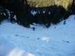
Snowshoes off now... as ragman postholes from Pickhandle Gap towards the basin.
|
BarbE leaving Pickhandle Gap... snow above her knees.
|
Not every step down is simple.
|
Still heading down to Pickhandle Basin.
|
BarbE in Pickhandle Basin (5400').
|
Crystal Mountain cabins (~5000')... we will follow the service road from the cabins to the top of the Gold Hills ski run.
|
The chair lift at the top of the Gold Hills ski run.
|
Looking down the Gold Hills ski run to the main lodge... almost back to the car now.
|
