Iron Bear, Jester Mountain and Point 5459 - 12.21.2011
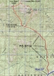
rodman's April 2009 GPS route for Iron Bear and Jester Mtn... I added the red dots to show how we made a loop hike out of the off-road portion of the hike... ~10 miles roundtrip, gaining ~3000 feet of elevation.
|
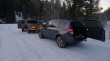
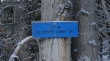
Drive 2 miles north of Mineral Springs on Hwy 97... and park (3000') on FS9714 where the snow stops you.
|
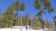
Today the snow stopped us at at the junction with Highway 97... leaving a 3 mile road walk to the summer trailhead.
|
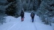
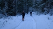
madman and rocman starting the 3 mile hike on FS 9714 that will get us to the summer trailhead.
|
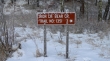
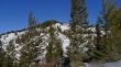
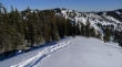
After walking FS 9714 for 2 miles we reached a junction with a road that leads to the Old Blewett Pass... but we will continue on FS 9714 for another mile.
|
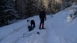
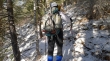
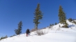
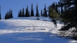
Time to put on our snowshoes at the end of the road (3600').
|
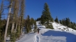
At the end of FS 9714 rocman crosses Iron Creek near the summer trailhead.
|
We have bypassed the summer trailhead and will use a rib that takes a more direct route to Iron Bear than the summer trail.
|
rocman and madman head up the rib that runs SE from the Iron Bear summit.
|
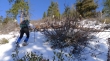
rocman picks up some extra baggage on the SE rib of Iron Bear.
|
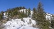
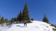
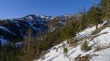
At ~4650' the brush thins out some.
|
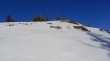
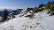
Nearing a bump (4800') on the SE rib of Iron Bear.
|
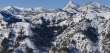
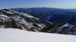
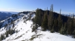
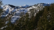
Pano taken from the 4800 foot bump... looking at Jester Mountain (far left), Point 5459 (right) and the ridge on the right that will get us back down to the road at the end of the day.
|
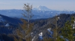
A closeup of Mount Rainier from the 4800 foot bump.
|
Looking up towards Iron Bear from the 4800 foot bump.
|
Looking SE to Table Mountain.
|

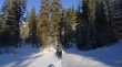
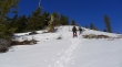
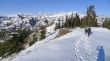
rocman and madman continue towards Iron Bear.
|
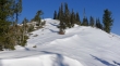
Continuing up.
|
Up and up towards Iron Bear.
|
Nearing the top of Iron Bear.
|
We can see the summit now.
|
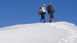
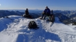
rocman and madman on the Iron Bear summit (5489').
|
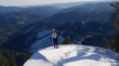
rocman and madman head for a nice looking viewpoint about 50 yards NW of the Iron Bear summit.
|
madman and rocman on the Iron Bear summit... with Mount Rainier between them.
|
Looking west from Iron Bear... Elbow Peak (far left)... Jolly Mtn (left center).
|
A closeup of Earl Peak (far left)... Mt. Stuart, Sherpa Peak and Navaho Peak on the right.
|
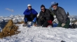
Group photo on Iron Bear... Mt. Stuart, Sherpa Peak and Navaho Peak in the distance on the left.
|
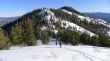
Looking SE to Table Mtn on the horizon... we came up to Iron Bear along the ridge in the lower right of the photo... after going over to Jester Mtn we will go to Point 5459 (far left)... then use the ridge in the center of the photo to get back down to FS 9714.
|
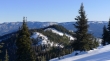
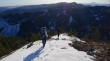
rocman and madman head towards Jester Mountain... we will have to give back ~150 feet of elevation to get over to Jester... Point 5459 on the far right.
|
After giving back 150 feet of elevation, madman is ready to start the 300 feet of elevation gain to the Jester Mountain summit.
|
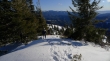
Looking for the Jester Mountain summit.
|
Looking back at Iron Bear.
|
Looking east towards Wenatchee from Jester Mountain.
|
madman and rocman on the Jester Mountain summit (5520+).
|
Leaving the Jester Mountain summit... we will need to give back 300 feet of elevation before heading back up to Point 5459 (center).
|
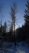
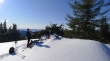
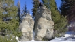
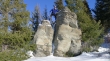
madman finds one of the very rare ice trees.
|

Ice tree.
|
Looking over at Iron Bear as we head for Point 5459... Rainier in the distance on the left.
|
Giving back elevation as we head for Point 5459 (second bump).
|
madman has found a couple of aliens.
|
Whatever madman does, rocman can do also.
|
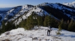
rocman nearing Point 5459... Iron Bear (left) and Jester Mtn (right) are behind.
|
madman and rocman near the top of Point 5459.
|
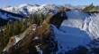
From Point 5459 we are looking across Navaho Peak, Miller Peak and Three Brothers to the Stuart Range.
|
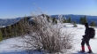
Continuing east from Point 5459 looking for the easiest way back down to FS 9714.
|
Heading down now... Iron Bear (left) and Jester Mtn (right)... with Earl Peak (center) in the distance... the top of Mt. Stuart behind Jester on the far right.
|
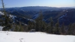
Looking south towards Ellensburg and Cle Elum as we head for FS 9714 in the valley floor.
|
rocman and madman continue down towards FS 9714... Mt. Rainier in the distance on the right.
|
Looking back at Iron Bear (left) and Jester Mtn (right)... we are still a half-hour away from FS 9714.
|
We've reached FS 9714... leaving a 3 mile road walk back to our cars... it is 3:30 p.m... and on the shortest day of the year, we will have to hustle to beat the darkness.
|
