Florence Peak - 2.15.2012
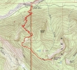
rodman's GPS route of our hike to Florence Peak in Mount Rainier National Park... 9.2 miles roundtrip, gaining 3920 feet of elevation.
|
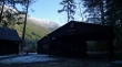
There is room for 4 cars to park at the Carbon River Ranger Station.
|
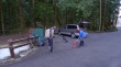
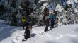
Snowdog and BarbE gearing up.
|
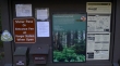
Information sign at the start of this hike... the West Boundary Trail starts out on the very short Rainforest Loop Trail.
|
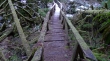
Talk about slippery.
|
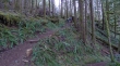
On the official West Boundary Trail now... where the trail steepens significantly.
|
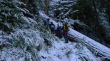
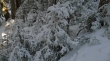
It didn't take very long to reach fresh snow... however, there wasn't very much of it.
|
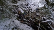
The only stream crossing on this trip.
|
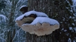
Big mushroom.
|
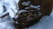
A bunch of little mushrooms.
|
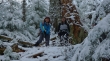
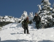
BarbE and Snowdog are all smiles in this Winter Wonderland.
|
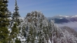
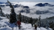
There was sunshine above the forest canopy... but we just couldn't seem to touch it.
|
Finally... some sunshine near the summit area.
|
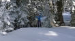
BarbE points to her watch... indicating that we need to stay on task.
|
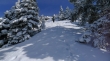
It got very steep just below the summit area.
|
Recon and ragman reach the false summit.
|
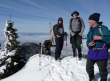
Recon, Snowdog, ragman and rodman on the false summit.
|
What is that over there?
|
That is the true summit... and we won't be going over there today... we don't care for light snow cover and ice on steep rock.
|
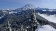
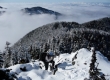
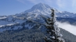
Awesome view of Mount Rainier... Howard Peak in the left foreground... then Tolmie Peak behind Howard.
|
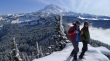
Mount Rainier and two sherpani chicks.
|
A closer look at Rainier.
|
Time to head down into the clouds.
|
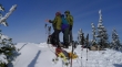
Snowdog and ragman heading down from the summit area.
|
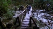
The puncheon bridges never did thaw out... back on the Rainforest Loop Trail now... about 3 minutes from the car.
|
