White Bluffs - North Slope - 4.5.2012
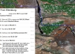
Google map directions to get from Ellensburg to the trailhead for the North Slope of the White Bluffs.
|
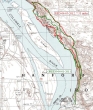
A closer look at the last few miles to the trailhead.
|
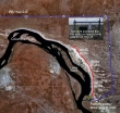
rodman's GPS routes for our 2011 (green) hike and our 2012 (red) hike. The main difference between the two hikes was that this year we stayed closer to the river when we were below the bluffs. 7.5 miles roundtrip, gaining 1050 feet of elevation.
|
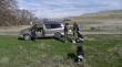
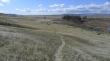
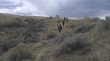
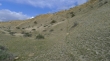
Park in a grassy area near the end of the road... look north and you will see the unsigned trail heading uphill towards the top of the bluffs.
|
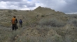
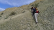
Looking back at our car and the rest of the group coming up the trail.
|
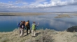
rodman is looking south as he got this shot of Denali Girl, ragman, Snowdog, BarbE and Izzy above the Columbia River.
|
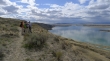
I got this shot of the folks looking north... Locke Island on the right.
|
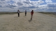
A pano shot... our group on the right... hiking north above the bluffs.
|
Getting closer to Locke Island... we will be returning via the plateau below.
|
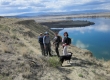
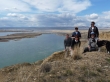
I'm looking south here as the group uses the binoculars to check out the herd of deer on Locke Island.
|
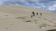
Heading for the sand dunes now.
|
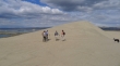
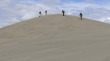
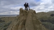
Snowdog, Denali Girl, rodman and BarbE near the top of the first dune... Izzy on the far right.
|
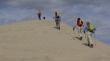
Nearing the summit of the first dune.
|
Looking south from the first sand dune... Locke Island in the middle of the river.
|
Looking north... more sand dune work to be done.
|
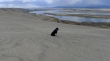
Ladies of the Wahluke National Wildlife Refuge.
|
One more lady enjoying the views.
|
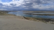
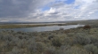
Looking north... two ponds come into view on the plateau below.
|
Reaching the top of the second sand dune.
|

Continuing north from the second sand dune...
|
Looking for the easiest way to get down to the plateau below the bluffs.
|
Earth colors... we have found the way down to the river.
|
Snowdog and Denali Girl coming down from the bluffs to the river.
|
BarbE and rodman... looking for a reasonable path over to the river.
|
Lunch time near the river.
|
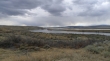
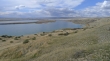
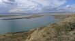
Locke Island from near our lunch spot.
|
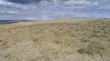
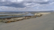
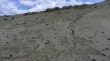
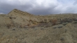
Different types of terrain on the plateau below the bluffs.
|
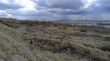
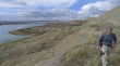
Continuing south... below the bluffs.
|
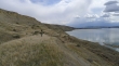
Looking south.
|
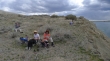
Snowdog and BarbE have found a nice perch.
|
Looks like a highrise apartment with a balcony for each apartment.
|
rodman on the plateau between the river and the bluffs.
|
Looking for the best way to get back up to the bluffs.
|
We have found the way to get back up to the bluffs.
|
Looking north.... on our way back up to the bluffs.
|
|
A pano shot.
|
Izzy and rodman are almost back to the top of the bluffs.
|
rodman got this shot of Izzy wondering why it is taking us so long to get back up to the top of the bluffs.
|
Back on top of the bluffs now... looking north.
|
BarbE got this group shot of us on top of the bluffs... a mile of hiking will get us back to the car.
|
