Iron Bear, Jester Mountain and Point 5459 - 6.3.2012
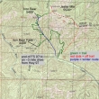
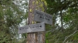
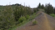
Drive 2 miles north of Mineral Springs on Hwy 97... then turn left onto FS 9714 and drive ~3 miles to the trailhead (3640'). Our loop trip was ~5.5 miles, gaining ~3000 feet of elevation.
|
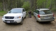
Gearing up at the parking area.
|
We will hike Trail #1351 to Iron Bear Pass.
|
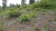
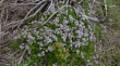
Balsamroot were abundant and vibrant.
|
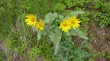
A closer look at some balsamroot.
|
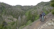
Denali Girl, Snowdog and robman on the Iron Bear Trail... I am looking up the Iron Creek drainage toward Iron Bear at the head of the valley.
|
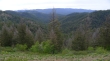
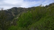
Looking down the Iron Creek drainage to Table Mountain in the distance... we will finish up our loop hike by coming down the brown rib in the left foreground.
|
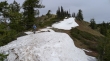
After hiking Trail #1351 for two miles we have reached Iron Bear Pass (~4400')... and will now take Trail #1364 on up to Iron Bear.
|
A beautiful patch of Jacob's Ladder at Iron Bear Pass.
|
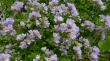
A closer look at Jacob's Ladder.
|
Leaving Iron Bear Pass and heading on up toward Iron Bear (left).
|
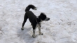
Izzy showing off her new haircut.
|
Denali Girl on the final approach to Iron Bear.
|
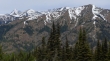
From Iron Bear... Miller Peak in the right foreground... with Little Navaho, Navaho and Three Brothers behind the ridge leading up to Miller... and distant views of Mt. Stuart (far left), Sherpa, Colchuck and part of Dragontail.
|
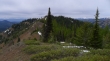
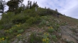
Looking back at Iron Bear as we make our way over to Jester Mountain... we will be off trail for the rest of the loop portion of the hike.
|
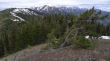
Jester Mountain (left) from near Point 5459... Miller Peak in the center of the photo... with some of the Stuart Range in the distance.
|
Izzy shows Snowdog and Denali Girl how to get down to the valley from Point 5459.
|
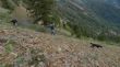
The terrain from Point 5459 down to the valley was not very friendly... very loose.
|
Still working our way down from Point 5459.
|
Almost back down to Iron Creek... Iron Bear above.
|
