Mount Hoffmann - Yosemite National Park - 8.18.2012
This hike and short scramble near the summit is 6 miles roundtrip, gaining 2004 feet of elevation.
|
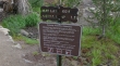
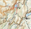
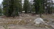
Start from the May Lake trailhead... drive the Tioga Road for 2.2 miles west of Olmstead Point... turn right onto the Old Tioga Road and drive 1.7 miles to the trailhead (8846').
|
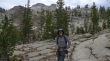
ragman on the trail to May Lake... the east end of Mount Hoffmann is above.
|
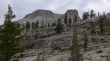
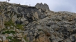
A closer look at the east end of Mount Hoffmann.
|
After hiking 1.2 miles we arrived at the May Lake High Sierra Camp (9350')... one of 7 such camps in Yosemite.
|
|
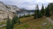
A pano shot of May Lake... we will continue to the left around the south side of the lake.
|
Leaving May Lake and heading up.
|
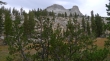
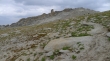
Gotta love the granite... the east end of Mount Hoffmann is above.
|
Continuing through a nice meadow before heading up again.
|
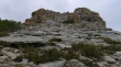
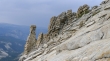
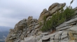
Nearing the summit... this is one of several interesting rock outcroppings on the summit area.
|
We didn't see much sunshine on this day... but did get a little bit on Half Dome for this shot.
|
Clouds Rest and Half Dome.
|
The Mount Hoffmann summit on the right... with Hoffmanns Thumb in the center.
|
A pano shot from near the Mount Hoffmann summit... the eastern end of the summit area is on the left... Hoffmanns Thumb on the far right.
|
Almost on the summit now... Half Dome and Hoffmanns Thumb on the left.
|
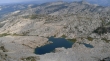
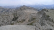
Unnamed Lake and tarns on the north side of Mount Hoffmann.
|
A short Class 2 scramble is required to reach the summit (10,850').
|
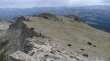
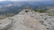
Mount Hoffmann is located at the geographical center of Yosemite... and there are broad views in all directions.
|
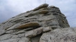
Interesting rock.
|
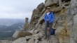
Denali Girl on the Hoffmann summit.
|
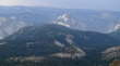
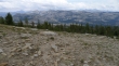
Looking NE to Tuolumne Peak in the center of the photo.
|
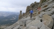
Heading down now... Hoffmanns Thumb and Denali Girl... notice that Denali Girl's pack is not on her back.
|
Continuing down... notice that Denali Girl's pack is resting above... she didn't realize this until we had descended another 100 feet... and yes, for those keeping score, I did retrieve it for her.
|
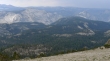
The weather is improving a bit as we head down... Tenaya Lake in the center of the photo... with the Cathedral Range behind.
|
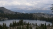
Back near May Lake... with Mount Conness dominating in the distance... 1.2 miles of hiking to get back to the car.
|
