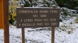
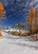
Fortune Peak - 10.17.2012
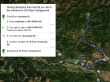
From Exit 85 on Interstate 90... use Hwy 970, Teanaway Road and the North Fork Teanaway Road to reach 29 Pines Campground... then...
|
From the entrance to 29 Pines Campground... drive 9.7 miles to the Esmerelda Basin Trailhead at the end of the road.
|
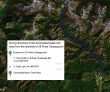
rodman's GPS route of our trip to Fortune Peak... 8.5 miles roundtrip, gaining 3190 feet of elevation.
|
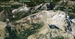
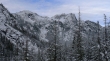
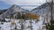
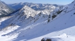
A google earth look at our approximate route from Ingalls Pass to Fortune Peak... today there was a lot more snow than in this photo.
|
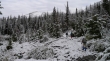
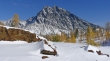
The thin layer of ice at the trailhead parking lot (4200') was a bit of a surprise.
|
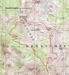
We will hike a short distance on the Esmerelda Basin Trail and then take the Ingalls Way trail.
|
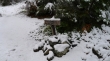
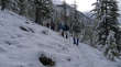
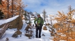
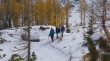
Jannu, Denali Girl and rocman on the Esmerelda Basin Trail... less than an inch of snow at this point.
|
After hiking for a quarter mile we will leave the Esmerelda Basin Trail and take the Ingalls Way Trail.
|
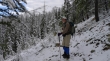
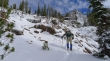
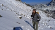
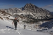
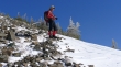
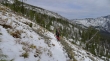
rocman on the Ingalls Way Trail... looks like sunshine in the distance up near Fortune Creek Pass... and we can see Fortune Peak.
|
East Esmerelda.
|
West Esmerelda.
|
Taking a brief stop on the Ingalls Way Trail.
|
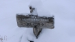
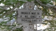
After hiking on the Ingalls Way Trail for ~1.5 miles we reached the junction for Longs Pass, but we will stay on the Ingalls Way Trail... the letters in 'Longs Pass Trail' are frozen.
|
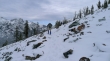
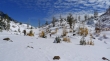
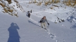
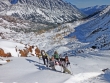
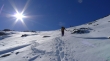
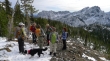
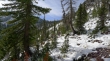
Heading for Ingalls Pass now... with a couple of inches of snow on the trail now.
|
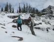
Dinara, Denali Girl and Jannu on the Ingalls Way Trail.
|
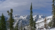
Esmerelda Peaks... the high point is on the bump in the center.
|
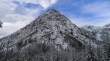
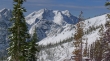
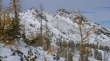
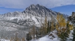
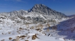
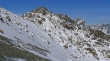
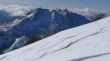
Fortune Peak.
|
Continuing on the Ingalls Way Trail.
|
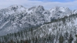
West Esmerelda on the left and Hawkins Mountain on the right.
|
Sunshine on West Esmerelda and Hawkins Mountain
|
A closer look at Hawkins Mountain.
|
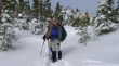
rocman nearing Ingalls Pass.
|
We have reached Ingalls Pass (6500') after hiking a total of ~3.5 miles.
|
rocman and Jannu at Ingalls Pass... with South Ingalls in the distance.
|
BarbE's photo of iraman at Ingalls Pass... with Mount Stuart in the distance.
|
BarbE's photo of dicey at Ingalls Pass.
|
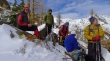
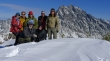
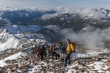
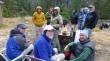
Rest stop at Ingalls Pass... madman, dicey, BarbE, rocman and iraman.
|
Dinara and rodman at Ingalls Pass.
|
Ingalls Peak from Ingalls Pass.
|
Mount Stuart from Ingalls Pass.
|
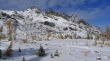
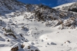
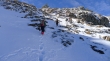
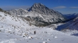
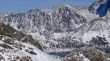
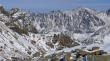
Dropping into Headlight Basin from Ingalls Pass... Fortune Peak is in the distance on the far ridge line.
|
rodman's photo of us entering Headlight Basin... someone is down there in a light blue jacket.
|
That would be nwhiker HikingQueen in the light blue jacket... posing with her facebook friend Snowdog.
|
From Headlight Basin we are looking back at Point 6878 (aka Not Hinkhouse Peak) on the left... and Ingalls Pass (center).
|
Denali Girl, Jannu and Dinara in Headlight Basin.
|
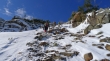
We have left the trench leading over to Ingalls Lake and are heading for Fortune Peak.
|
Ingalls Peak from Headlight Basin.
|
Mount Stuart from Headlight Basin.
|
A Bev Doolittle moment.
|
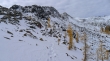
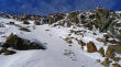
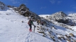
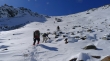
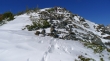
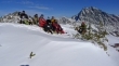
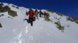
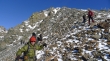
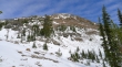
On steeper terrain now... and heading for the east ridge of Fortune Peak.
|
madman was shooting photos in the basin and got this shot of us heading for Fortune Peak.
|
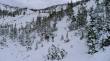
Now we know why madman stayed back in the basin for awhile.
|
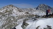
Ascending.
|
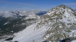
Looking across Headlight Basin to Jack Ridge and Mount Stuart.
|
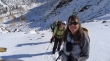
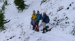
Sunshine has a way of producing smiles in the mountains... madman has already caught up with dicey and Snowdog.
|
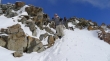
madman packing his tripod... as we wind our way through the boulders.
|
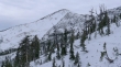
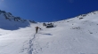
Continuing up.
|
More up.
|
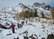
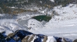
BarbE's photo... looking down on us as we head for the east ridge of Fortune Peak... Headlight Basin below.
|
BarbE leading the way.
|
Snowdog still smiling... with Jack Ridge in the distance.
|
iraman ascending.
|
Nearing the east ridge of Fortune Peak.
|
Looking back at Point 6878 and Ingalls Pass... Three Brothers, Navaho, Earl and other Teanaway Peaks in the distance.
|
The spotlight is on iraman as he nears the east ridge of Fortune Peak.
|
madman got this shot of iraman and me as we near the east ridge of Fortune Peak... Ingalls Lake is above iraman's head.
|
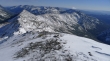
The three summits of Ingalls Peak from the east ridge of Fortune Peak.
|
Looking down the east ridge of Fortune Peak to Ingalls Pass and Point 6878... Esmerelda Basin is below on the right.
|
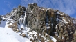
Hawkins Mountain from the east ridge of Fortune Peak.
|
iraman and madman nearing the Fortune Peak summit.
|
Ingalls Peak, Jack Ridge and Mount Stuart... with Ingalls Lake below.
|
A closeup of Ingalls Lake and Jack Ridge... Cashmere Mountain is in the distance on the far left.
|
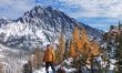
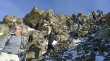
Summit party at 7382 feet.
|
Looking down on Lake Ann from the Fortune Peak summit.
|
BarbE looks like she is preparing to do some wingsuiting... google it if you aren't familiar with it... South Ingalls Peak (left), Jack Ridge and Mount Stuart in the distance.
|
A closeup of East Ingalls (far left foreground), Cashmere Mountain (distant) and Jack Ridge.
|
Looking north... South Ingalls in the right foreground.
|
Front row... ragman and rodman... back row... BarbE, iraman, dicey, madman and Snowdog... and of course, Mount Stuart.
|
Descending the west ridge of Fortune Peak.
|
madman on the west ridge of Fortune Peak.
|
madman's shot of us descending the west ridge of Fortune Peak... everyone is still smiling.
|
Continuing our descent.
|
Still heading down.
|
More down.
|
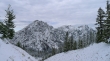
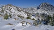
Looking up at Fortune Peak... we have found the County Line Trail in the small basin on the SW side of Fortune Peak... and will follow it down to the Esmerelda Basin Trail.
|
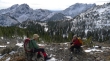
madman and iraman discussing the price of pork bellies... with West Esmerelda (left) and Hawkins Mountain in the distance.
|
Now everyone wants to talk about pork bellies... Esmerelda Peaks in the distance.
|
On the County Line Trail now... and heading for the Esmerelda Basin Trail.
|
Almost back to the Esmerelda Basin Trail... leaving a 3 mile hike back to the car... Fortune Creek Pass in the distance.
|
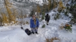
BarbE's photo of party time at the trailhead... life is good.
|
