Granite Mountain - 11.5.2012
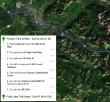
Directions from the Preston Park and Ride to the Pratt Lake Trailhead.
|
rodman's GPS route from December 2009... 8 miles roundtrip... gaining ~3800 feet of elevation.
|
A google earth look at Granite Mountain... but there wasn't any snow on this trip.
|
We started at the Pratt Lake Trailhead (~1800')... Exit 47... north side of I-90.
|
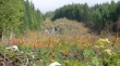
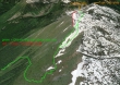
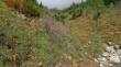
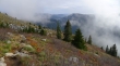
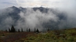
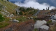
We are on the Pratt Lake Trail and still haven't reached the junction with the Granite Mountain Trail... I don't remember the avalanche gully extending this far down the mountain.
|
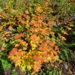
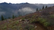
Vine maples showing their fall colors.
|
After hiking the Pratt Lake Trail for one mile, we took the Granite Mountain Trail.
|
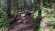
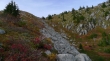
The terrain steepens on the Granite Mountain Trail.
|
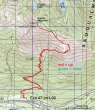
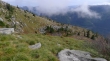
Crossing the first avalanche gully at ~3800 feet.
|
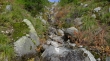
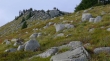
Crossing the second avalanche gully at ~4000 feet.
|
After crossing the second avalanche gully we traversed west for a half-mile underneath Granite's SE ridge... and are now turning the corner to get on the SE ridge.
|
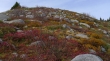
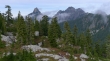
Nice fall color on Granite's SE ridge.
|
Can't quite see the lookout yet.
|
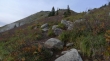
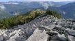
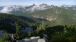
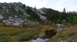
Beautiful little shelf at ~4800 feet.
|
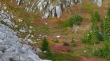
A closer look at the small shelf.
|
Continuing up Granite's SE ridge.
|
Looking back down at the small shelf... and can barely see Keechelus Lake through the gap.
|
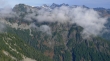
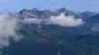
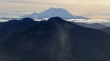
Looking across I-90 to Silver Peak and Abiel Peak on the left... with Mt. Rainier barely visible beyond Humpback Mountain on the right.
|
Looking back on the small shelf as we continue up Granite's SE ridge.
|
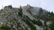
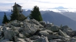
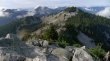
The Granite Mountain Lookout is in view.
|
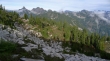
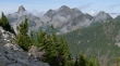
Continuing up Granite's SE ridge... the trail is in the basin below... Kaleetan Peak (left) and Chair Peak in the distance.
|
I'm going to take the Class 2 scramble route along the SE ridge (left)... while the trail is in the basin on the right and comes up the ridge on the right to the lookout.
|
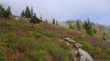
A better look at the trail in the basin.
|
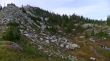
Big boulders on Granite's SE ridge... where I will definitely be using my hands in places.
|
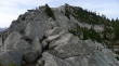
No question that the easiest route to the lookout is via the trail in the basin on the right.
|
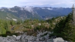
Gaining elevation on Granite's SE ridge... looking down on the trail in the basin below... I-90 crossing Snoqualmie Pass in the center of photo... broad views from Snoqualmie Mountain (left) to Rampart Ridge on the right.
|
Views broaden with each step up... Kaleetan Peak on the left to Lemah Mountain on the far right.
|
Almost to the lookout.
|
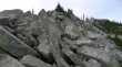
Looking back down at my boulder route on Granite's SE ridge.
|
A closeup of Snoqualmie Mountain (left)... with Overcoat Peak, Chimney Rock and Lemah Mountain in the center... and Chikamin Peak and Four Brothers on the right.
|
A closeup of Kaleetan Peak (left), Chair Peak and Bryant Peak... the snow covered Glacier Peak in the distance on the right.
|
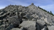
On the Granite Mountain summit (5629') now... looking south to Mount Rainier.
|
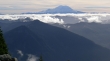
A closeup of Mount Rainier.
|
Looking across Crystal Lake and Tuscohatchie Lake to the foreground peaks of Kaleetan, Chair, Bryant and The Tooth... with Big Snow Mountain in the distance on the right.
|
Tusk O'Granite from the Granite summit... Bandera Mountain, Mt. Defiance and Pratt Mountain to the left.
|
Looking across Alta Mtn, Three Queens and Hibox Mountain to the sunshine hitting Mount Stuart in the distance.
|
Looking back up at the lookout as I return via the trail in the basin... Granite's SE ridge on the left.
|
Back to the small shelf at 4800 feet.
|
Looking across Humpback Mountain to Mount Rainier.
|
Silver Peak, Abiel Peak and Humpback Mountain... ~3 miles to get back to the car.
|
