Pratt Mountain - 12.10.2012
|
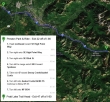
Directions from the Preston Park and Ride (Exit 22 on I-90) to the Pratt Lake Trailhead (Exit 47 on I-90).
|
rodman's GPS track for our snowshoe trip to Pratt Mountain... 9.7 miles roundtrip, gaining 3445 feet of elevation.
|
A google earth look at the terrain around Pratt Mountain... the entire area was covered with snow on our trip.
|
A dusting of snow at the Pratt Lake Trailhead (~1800').
|
Taking a break at the 1 mile mark (~2600') where the trail junctions with the Granite Mountain Trail... no need for snowshoes yet.
|
|
Continuing on the Pratt Lake Trail.
|
There are at least 10 easy stream crossings on the Pratt Lake Trail.
|
At approximately the 3 mile mark we put on our snowshoes (~3700')... left the Pratt Lake Trail and took the trail that leads toward Talapus Lake.
|
Snowdog proving that she can walk on water... as we cross the stream that flows out of Olallie Lake.
|
After crossing the stream we followed it a short distance toward Olallie Lake... then angled left and headed uphill.
|
|
At ~4200 feet we crossed the Mt. Defiance Trail and continued uphill in search of the ridge that would lead us to the Pratt Mountain summit.
|
On Pratt's SE ridge now at ~4500 feet... where the large rock outcropping is the crux of the trip.
|
Recon at the large rock outcropping... following the track that BarbE set... bless her heart.
|
BarbE, Snowdog and rodman at the rock outcropping... the terrain is very steep to our right.
|
Recon hugging the rock outcropping to avoid the steep terrain on the right.
|
|
Finally beyond the rock outcropping... an easy ridge walk remains to the summit.
|
Definitely getting more foggy as we gain elevation.
|
Brrrrr....
|
More brrrrr...
|
Really close to the Pratt Mountain summit now.
|
|
One more brrrrr shot.
|
Where is Waldo?
|
There is Waldo.
|
rodman got this summit (5099') shot ... BarbE, Snowdog, ragman and Recon.
|
Ms. Isabel was also on the summit... distant views were nonexistant.
|


