Mazama Ridge - 1.21.2013
|
Drive 6.5 miles from the Nisqually entrance of MRNP to Longmire... then drive 8.1 miles from Longmire to the Narada Falls parking area (4564').
|
This shows our approximate route and is not a GPS track... we made a partial loop out of the trip by going to Reflection Lakes via the Stevens Canyon Road... and returning to the car via the wanded route on the north side of Point 5370.
|
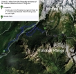
A google earth look at the terrain around Mazama Ridge.
|
The Narada Falls parking lot was a skating rink today.
|
Snow and ice on the roof of the comfort station at Narada Falls.
|
|
Watch for this sign just north of the comfort station... it marks the beginning of the easiest route up to Stevens Canyon Road.
|
The roof of the maintenance shed just north of the Narada Falls comfort station.
|
The route is marked by orange and black wands.
|
Snowdog was on the trip...
|
and so was Denali Girl.
|
|
With the low avalanche warning today, we decided to use the Stevens Canyon Road to go over to Reflection Lakes... here we are on the road looking down on the Narada Falls parking lot and maintenance shed.
|
Looking down on Narada Falls and the parking area from the Stevens Canyon Road.
|
Mount Rainier from the Stevens Canyon Road.
|
Pinnacle Peak from the Stevens Canyon Road.
|
Reflection Lakes... where we will follow orange and black wands up to a saddle (~5160') between Point 5370 and Mazama Ridge.
|
|
At the saddle between Point 5370 and Mazama Ridge... no more wands to show the way to Mazama Ridge, but today there is an obvious trench to show the way.
|
Continuing higher on Mazama Ridge... looking south to six of the Tatoosh Range peaks.
|
Did I mention that there was a good path on Mazama Ridge.
|
Tatoosh Range peaks... The Castle (left), Pinnacle Peak, Plummer Peak and Denman Peak.
|
First good look at Mount Rainier from Mazama Ridge.
|
|
Tatoosh Peaks... Stevens Peak (left), Unicorn Peak (center), an unnamed peak and Manatee Peak on the right.
|
A closeup of Stevens Peak.
|
A closeup of Unicorn Peak and Manatee Peak.
|
Continuing NE along Mazama Ridge and looking back at the Tatoosh Range.
|
Snowdog on Mazama Ridge... heading toward Mount Rainier... Little Tahoma to the right.
|
|
Looking back on some of the Tatoosh Peaks... Stevens on the left to Plummer on the right.
|
Our lunch spot (~5700') today... not too shabby of a view.
|
A closeup of Rainier from our lunch spot.
|
A closeup of Little Tahoma from our lunch spot.
|
Snowdog on Mazama Ridge and heading for the barn... Tatoosh Range in the distance.
|
|
Denali Girl found a nice place on Mazama Ridge to wait for our return... The Castle and Pinnacle Peak in the distance.
|
Denali Girl and Snowdog between The Castle and Pinnacle Peak.
|
The Castle (left), Pinnacle Peak, Plummer Peak and Denman Peak.
|
Last good look at Rainier until we get back to the car and start driving home.
|
Snowdog and Denali Girl on Mazama Ridge... ~2 miles of hiking will get us back to the car.
|


