'Not So Sasse' Peak - 2.20.2013
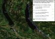
Directions to the Cle Elum River Campground... our starting point for the snowshoe trip to 'Not So Sasse' Peak.
|
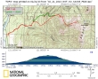
rodman's GPS track for our trip to 'Not So Sasse' Peak... 6 miles roundtrip, gaining 3288 feet of elevation.
|
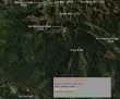
A google earth look at the terrain around 'Not So Sasse' Peak... completely covered by snow today. I would not recommend the slight detour we took on the way back down.
|
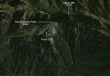
A closer google earth look at the terrain around 'Not So Sasse' Peak.
|
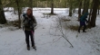
Starting out (2268')... where we parked in a plowed area along side the Salmon La Sac Road near the Cle Elum River Campground.
|
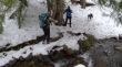
Crossing (~2640') Howson Creek.
|
Shortly after crossing Howson Creek the terrain steepened significantly.
|
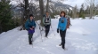
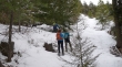
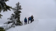
Are we having fun yet... rodman, Snowdog and BarbE.
|
rodman leading us uphill.
|
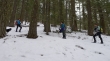
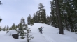
BarbE leading us through some old-growth timber.
|
High enough now to look across valley to Red Mountain.
|
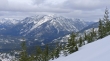
Looking across valley to Davis Peak.
|
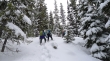
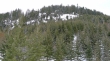
Continuing up a nice open area on the north side of the old-growth forest.
|
Back into the trees around 4700 feet.
|
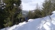
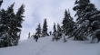
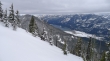
Starting to get a view SW to Cle Elum Lake.
|
BarbE doing some serious trail breaking as we near a ridge.
|
BarbE on the ridge (~5000').
|
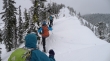
From the ridge (~5000') we get our first view of 'Not So Sasse' Peak.
|
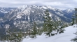
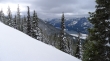
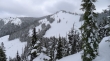
Looking SW at Cle Elum Lake... Kachess Ridge on the right... Point 5159 in the left foreground.
|
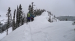
Snowdog leading along the narrow ridge that leads to 'Not So Sasse' Peak.
|
Respecting the cornices on the south side of the ridge.
|
rodman, BarbE and Snowdog on the summit (5568') of 'Not So Sasse' Peak.
|
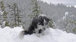
Ms. Isabel was diggin' it on the summit.
|
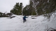
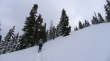
On the return trip I led the group into a cliff band that was not fun... crampons/microspikes saved the day.
|
Looking back at the nasty cliff band... on the trip up we stayed in the trees to the right of the cliff band... on much friendlier terrain.
|
