Turtlehead Peak - 3.31.2013
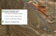
Directions to the Turtlehead Peak Trailhead from the entrance to the Red Rock Canyon National Conservation Area.
|
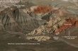
A google earth look at the area around Turtlehead Peak. A Class 2 climb that is ~5 miles roundtrip, gaining 2075 feet of elevation.
|
Driving past the Calico Hills which are also in the Red Rock Canyon National Conservation Area.
|
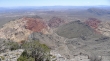
From the Calico Hills we can see Turtlehead Peak in the distance (left center).
|
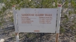
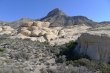
The Turtlehead Peak Trailhead is located in the Sandstone Quarry Area of the RRCNCA.
|
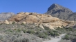
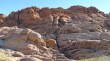
The trail passes by a lot of sandstone rock on the way to the Turtlehead summit.
|
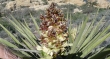
Yucca Cactus in bloom.
|
Indian Paintbrush.
|
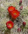
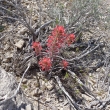
Claret Cup Cactus.
|
Still working around the sandstone.
|
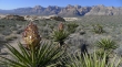
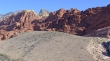
Looking back as we continue toward Turtlehead Peak... Yucca, sandstone and red rock.
|
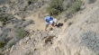
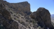
Denali Girl on some of the Class 2 sections of the hike.
|
Gaining elevation on the steep hillside and gully leading to the summit ridge.
|
The hardest part of the hike is getting to the summit ridge... we are almost there... then an easy walk over to the summit (center).
|
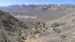
From the Turtlehead summit (6285') we are looking across the Calico Hills to Las Vegas.
|
