Wilson Mountain - 4.3.2013
Directions from Sedona to the Encinoso Picnic Area... the starting point for the N. Wilson Mountain Trail.
|
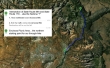
A google earth look at the terrain around Wilson Mountain... ~9 miles roundtrip, gaining 2512 feet of elevation... if you skip doing the Sedona Overlook, subtract 150 feet of elevation and .8 miles.
|
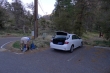
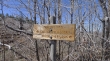
Parking at the north end of the Encinoso Picnic Area... you can see the trailhead sign 30 feet in front of the car.
|
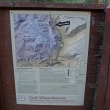
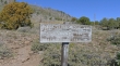
The N. Wilson Mountain Trailhead... we had already dropped off one car at the S. Wilson Mountain Trail just north of Midgley Bridge.
|
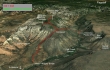
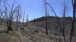
Wilson Mountain above... a huge mountain more than two miles long and one mile wide... the trail will take us into the canyon above.
|
Wilson Mountain is the highest point in the Red Rock Secret Mountain Wilderness.
|
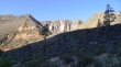
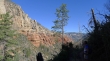
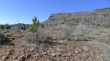
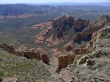
Cliffs on the east side of Wilson Mountain.
|
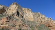
A closer look at the cliffs on the east side of Wilson Mountain.
|
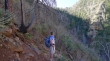
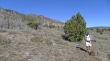
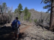
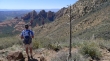
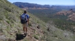
larman switchbacking up the side of a canyon that will take us up to the 'First Bench' of Wilson Mountain.
|
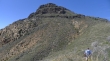
Gaining elevation and almost to the 'First Bench'.
|
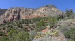
Improving views as we gain elevation.
|
Out in the open now... just below the 'First Bench'... Wilson Mountain summit area on the right.
|
The 'First Bench' is a huge plateau on the east side of Wilson Mountain... the summit is somewhere on the right but not obvious.
|
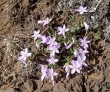
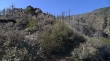
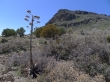
Didn't expect to see spring beauties on this hike... but there were a lot of them.
|
We are on the 'First Bench'... looking for the junction with the S. Wilson Mountain Trail... the red volcanic tuft on the skyline is very near the summit.
|
We have reached the junction where the south and north Wilson Mountain trails meet... and will now switchback up to a saddle between the Sedona Overlook and the summit.
|
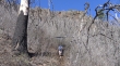
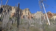
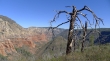
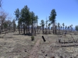
larman switchbacking through a gnarly looking burn area on the east side of Wilson Mountain.
|
The saddle... go south to the Sedona Overlook... or north to the Wilson Mountain summit.
|
Looking south to the Sedona Overlook.
|
From the saddle we are looking north to the Wilson Mountain summit... we will follow the trail for a short distance, then leave it and head for the summit.
|
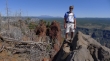
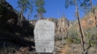
larman on the Wilson Mountain summit (7122')... with the red volcanic tuft behind.
|
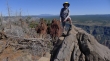
ragman was also there... the snow-capped mountain in the distance is the 12,637 foot Humphreys Peak located near Flagstaff... the highest point in Arizona.
|
After leaving the summit we decide to head over to the Sedona Overlook.
|
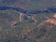
Looking down Wilson Canyon to Midgley Bridge from the Sedona Overlook... our other car is down there.
|
Wilson Canyon from the Sedona Overlook.
|
Back down on the 'First Bench'... looking up toward the Sedona Overlook.
|
larman looking into Wilson Canyon.
|
Leaving the 'First Bench' and starting to switchback down into Wilson Canyon... the Sedona Overlook is above.
|
Still switchbacking down into Wilson Canyon... the line of red rock formations above larman's head is Mitten Ridge... Steamboat Rock is on the far right of the photo.
|
Almost back to Midgley Bridge and our car... looking back up Wilson Canyon to the Sedona Overlook.
|
