Weir Trail - 4.17.2013
Directions to the Weir Trailhead... which actually begins on the Bell Trail.
|
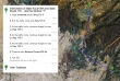
A google earth look at the terrain around the Weir Trail.
|
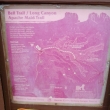
The Bell Trail provides an access to several other trails.
|
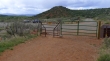
The parking area for the Bell/Weir trailhead.
|
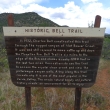
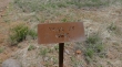
Some history about the Bell Trail.
|
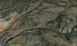
We will continue up this valley... following along Wet Beaver Creek.
|
We will be hiking in the Wet Beaver Wilderness.
|
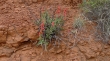
Penstemon.
|
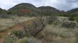
Continuing up valley.
|
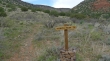
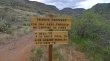
Bypassing the White Mesa Trail and continuing up valley.
|
After hiking on the Bell Trail for 2.5 miles we have arrived at the Weir Trail.
|
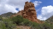
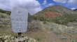
Nice rock formations.
|
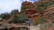
Denali Girl on the Weir Trail... getting ready to drop down to Wet Beaver Creek.
|
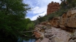
A nice shelf to relax on just above Wet Beaver Creek.
|
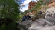
Group shot... Denali Girl, ragman, rocman and Jannu.
|
