Capitol Butte - 4.26.2013
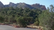
Directions to the Chuck Wagon Trailhead... this is a good spot to park for Capitol Butte although you won't be using a trail that starts here.
|
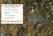
A google earth look at the terrain around Capitol Butte... 4.6 miles roundtrip, gaining 1830 feet of elevation.
|
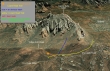
From the Chuck Wagon Trailhead... Lizard Head is near the end of the ridge line on the right... Capitol Butte is just out of view on the left.
|
From the parking area, walk back down the Vultee Arch Road .1 miles and start walking toward Lizard Head on the Lizard Head Trail.
|

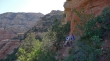
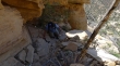
Pretty, but no idea what it is.
|
Snowdog and robman resting below Lizard Head.
|
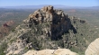
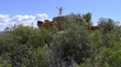
Snowdog on the ridge now... in front of Lizard Head... Cockscomb Butte in the distance on the left... Bear Mountain on the right.
|
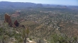
Bear Mountain on the left... Boynton Canyon and Long Canyon in the center of the photo.
|
Snowdog staying in touch with her constituency.
|
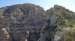
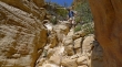
Successfully around the first rock outcropping on the ridge... and looking at the much larger rock cropping on the right... summit on left.
|
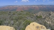
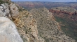
Looking across Sedona and the airport mesa to Courthouse Butte, Bell Rock and Cathedral Rock.
|
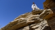
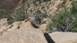
I'm up here and you aren't.
|
Looking back at the rock outcroppings on the SW ridge of Capitol Butte.
|
robman ascending.
|
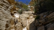
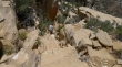
robman ascending... there were a few areas of Class 3 climbing.
|
Snowdog ascending.
|
Snowdog on the summit (6355').
|
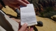
rocman and I had signed the register six days earlier.
|
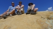
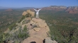
Group shot on the summit... robman, Snowdog and ragman.
|
Point 5977 in the foreground... with Wilson Mountain in the distance.
|
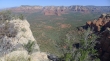
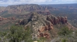
Bear Mountain, Boynton Canyon and Long Canyon from the Capitol Butte summit.
|
Point 5958 from near the Capitol Butte summit.
|
Snowdog descending.
|
robman descending.
|

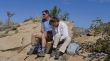
robman and Snowdog found a nice spot to relax in the shade.
|
