Earl Peak - 5.6.2013
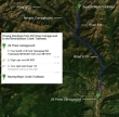
Directions from 29 Pines Campground to the Beverly/Bean Trailhead... our starting point for Earl Peak.
|
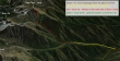
A google earth look at the terrain around Earl Peak.
|
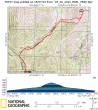
rodman's GPS route of our trip to Earl Peak... ~6 miles roundtrip, gaining ~3450 feet of elevation. While the GPS track shows us crossing Bean Creek, I can assure you that we did not cross it today.
|
The drive to the trailhead (~3600') was snow-free.
|
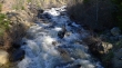
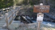
Lordy lordy... Beverly Creek is raging.
|
The original plan was to head up Beverly Turnpike and do Iron Peak or Teanaway Peak... but we deemed it to dangerous to try and cross the creek.
|
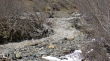
We continued up to check out the Bean Creek crossing a quarter mile upstream from the trail junction... and crossing here was not an option either.
|
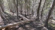
We left the main trail and headed uphill on the east side of Bean Creek.l
|
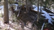
We continued cross-country along the east side of Bean Creek... basically staying 100 to 150 feet above the creek.
|
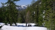
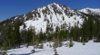
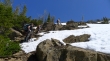
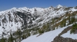
The terrain opened up around 5200 feet... as we neared the entrance to Bean Creek Basin.
|
The Earl Peak summit is up there somewhere.
|
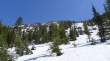
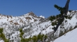
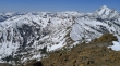
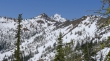
Looking across valley to the ridge (left) that leads to Judy Peak... with Bean Peak up valley on the far right.
|
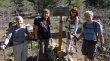
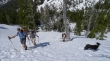
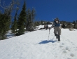
Here come the troops.
|
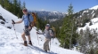
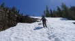
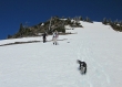
Ascending on steep terrain now... Izzy is always on patrol.
|
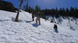
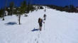
iraman and rodman ascending... with Mt. Rainier in the distance.
|
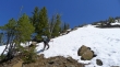
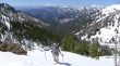
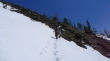
Continuing up... a skier carved some nice turns on the other side of the gully where the summer trail is located.
|
Someone ripped the seat of their pants during the bushwhack portion of the hike... and shows another good use of duct tape.
|
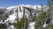
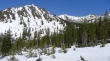
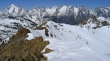
Gaining elevation quickly now... looking across Bean Creek Basin to Judy and Mary Peaks.
|
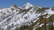
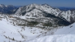
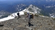
High enough now to see Mt. Stuart to the right of Bean Peak.
|
Just follow the pink duct tape.
|
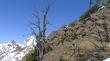
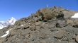
A little intermittent rock is nice.
|
rodman ascending... with Mt. Rainier on the horizon.
|
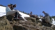
A well-deserved break... but there is still plenty of work left to do.
|
High enough now to see Sherpa Peak to the right of Mt. Stuart.
|
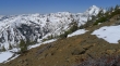
A good look into Bean Creek Basin.
|
Onward and upward.
|
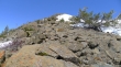
Will it never end?
|
At ~6200 feet we decided to get off of the snow and work our way over to the south ridge of Earl Peak.
|
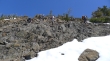
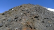
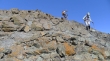
Looking for the good path on the south ridge.
|
BarbE and Snowdog ascending.
|
On the south ridge now... with summit in view.
|
An abundance of Teanaway Peaks and Alpine Lakes Wilderness Peaks.
|
Reeling in the Earl Peak summit.
|
BarbE on the summit... with Mt. Stuart in the distance on the left.
|
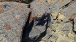
Lady Bug mating season on the summit... ladies, please!
|
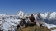
Group shot from the Earl Peak summit (7036')... ragman, iraman, BarbE, Snowdog and rodman.
|
The Stuart Range from Earl Peak.
|
Looking north and west across Bean Creek Basin into the heart of the Alpine Lakes Wilderness.
|
East to Navaho Peak and Three Brothers.
|
Time to head down.
|
We will continue down the south ridge to the saddle where the summer trail crosses over into the Standup Creek drainage.
|
Last look at Stuart and Sherpa as we descend.
|
I think that Izzy had more fun today than anyone else.
|
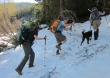
Almost done with the bushwhacking.
|
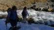
Bean Creek is still roaring... a half-mile walk to get back to the car.
|
