Navaho Peak - 6.4.2013
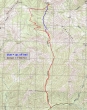
Directions from the entrance of Twentynine Pines Campground to the Stafford Creek Trailhead.
|
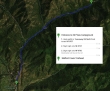
A google earth look at the terrain around Navaho Peak.
|
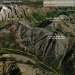
rodman's GPS track of our trip to Navaho Peak... on the way up we took an off-trail route to the summit... then used the trail all the way back to the car... 11 miles roundtrip, gaining 4276 feet of elevation.
|
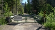
Due to logging activity, access to the Stafford Creek trailhead is currently blocked at Stafford Creek... but this only adds a 100 foot road walk to reach the trailhead.
|
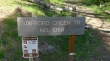
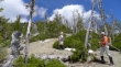
Stafford Creek Trailhead... ~3050 feet.
|
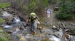
After hiking the Stafford Creek Trail for 3.5 miles, there is a major stream crossing at 4800 feet.
|
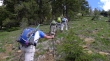
Leaving the trail immediately after crossing the major stream at 4800 feet... and heading steeply uphill.
|
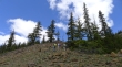
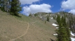
Continuing uphill... staying left of a huge gully.
|
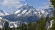
Gaining elevation quickly... looking over at Freedom Peak (aka Little Navaho).
|
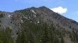
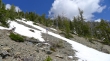
Patchy snow at ~5500 feet.
|
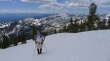
Continuing up... almost as high as Freedom Peak in the distance.
|
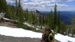
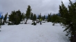
I was kind of surprised by the lack of snow.
|
Continuing up.
|
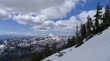
High enough now to see beyond Earl Peak and out to Mt. Rainier.
|
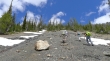
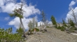
The last 400 feet of elevation gain to the summit was on continuous snow.
|
larman ascending... Mt. Rainier and Earl Peak beyond.
|
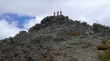
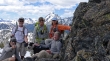
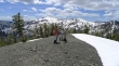
The gang is gathering on the Navaho Peak summit (7223').
|
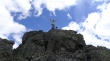
Snowdog and Izzy celebrate the summit... let the clouds part.
|
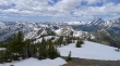
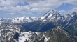
A summit view of the Teanaway Peaks, Mt. Stuart and Sherpa Peak.
|
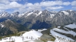
The Stuart Range from the Navaho summit.
|
A closer look at Ingalls Peak, Mt. Stuart and Sherpa Peak.
|
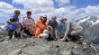
Group shot on the Navaho summit... Snowdog holding Izzy, larman, BarbE, rodman and ragman.
|
A better group shot taken just below the summit.
|
Looking at Mt. Stuart as we head down from the Navaho summit on the trail.
|
The trail down from the summit was mostly snow-free.
|
On the County Line Trail now and heading for Navaho Pass... Earl Peak in the distance.
|
Almost down to Navaho Pass.
|
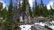
At Navaho Pass.
|
BarbE descending from Navaho Pass... back on the Stafford Creek Trail now... the Navaho Peak summit is somewhere above.
|
At the trail junction of Standup Creek and Stafford Creek... we will continue down the Stafford Creek trail for a half-mile to where we left the trail earlier in the day... leaving a 3.5 mile hike back to the car.
|
