Teanaway Peak - 6.22.2013
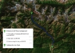
Directions to the Iron Peak Trailhead... the trailhead we used to do Teanaway Peak.
|
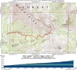
rodman's GPS track from June 14, 1997... the same route we used on this trip... ~5 miles roundtrip, gaining 2752 feet of elevation.
|
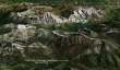
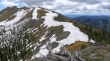
A google earth look at the terrain around Teanaway Peak.
|
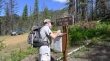
Ranger Steve signs us in at the Iron Peak Trailhead (3960 feet).
|
Esmeralda Peak on the left... with Fortune Peak and South Ingalls Peak in the distance on the right.
|
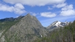
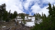
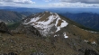
After hiking 2 miles we have reached the Iron/Teanaway saddle (~6200')... Teanaway Peak above.
|
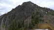
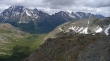
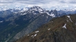
From the Iron/Teanaway saddle... Bills Peak on the left... with Volcanic Neck, Bean Peak, Marys Peak and Judys Peak on the ridge line in the distance.
|
From the Iron/Teanaway saddle Ranger Steve started up toward the Iron Peak summit to check out a goat.
|
budman starting up Teanaway Peak from the Iron/Teanaway saddle... looking at the ridge walk leading to Iron Peak.
|
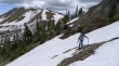
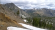
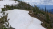
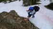
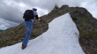
budman crossing some of the small snow fingers on the SE side of Teanaway Peak... Iron Peak on the left.
|
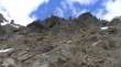
Looking up at the cliffy SE side of Teanaway Peak... we are on easier terrain just below the cliffy area.
|
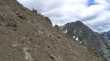
Working our way over to the east ridge of Teanaway Peak... the target is the small tree in the upper left portion of the photo.
|
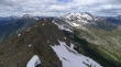
budman ascending... Bills Peak in the left foreground... we are high enough now to see Navaho Peak and Earl Peak on the horizon.
|
The Teanaway Peak summit is in view.
|
Trading off between snow and rock on the last 200 feet of elevation gain to the Teanaway Peak summit.
|
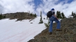
budman ascending.
|
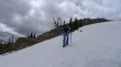
Still ascending.
|
Very close to the Teanaway Peak summit (6779').
|
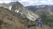
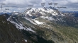
The Stuart Range from the Teanaway summit... everything was visible except for the summit area of Mt. Stuart.
|
Fortune Peak and the three summits of Ingalls Peak were in the sunshine.
|
Peak identification.
|
Looking across Esmeralda Peaks to Hawkins Mountain in the center of the photo.
|
Iron Peak from the Teanaway Peak summit.
|
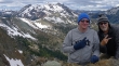
Group shot from the summit... budman and ragman.
|
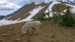
Back down at the Iron/Teanaway saddle now... and a closer look at the goat... with Iron Peak in the distance. It will be an easy two mile hike back to the car.
|
