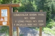
South Ingalls Peak - 7.3.2013
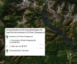
Directions from the entrance to 29 Pines Campground to the Ingalls/Esmeralda Trailhead at the end of the N. Fork Teanaway Road.
|
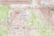
Our approximate route from Ingalls Pass to the South Ingalls summit and back to the pass... the entire trip (car-to-car) was ~8.5 miles roundtrip, gaining ~3800 feet of elevation.
|
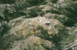
A google earth look at the terrain around Ingalls Peak.
|
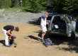
Gearing up at the Ingalls/Esmeralda Trailhead (~4200').
|
We will follow the Esmeralda Basin Trail for a short distance and then turn onto the Ingalls Way Trail.
|
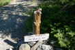
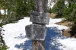
The sign at the junction of the Esmeralda Basin Trail and Ingalls Way isn't doing too well... take the right fork here.
|
After hiking ~2 miles we reached the junction of the Ingalls Way/Longs Pass trails... we stayed on Ingalls Way and headed for Ingalls Pass.
|
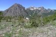
Fortune Peak from the Ingalls Way Trail.
|
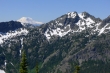
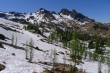
Esmeralda Peaks and the east end of Hawkins Mountain from the Ingalls Way Trail.
|
The twin west summits of Esmeralda Peaks... with Mount Rainier in the distance.
|
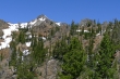
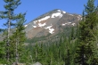
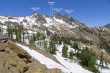
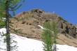
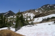
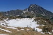
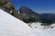
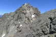
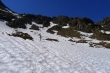
Nearing Ingalls Pass... and looking across it to South Ingalls Peak on the left... with the north and east summits on the right.
|
larman approaching Ingalls Pass... with 'Not Hinkhouse' Peak behind.
|
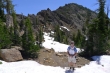
Crossing into the Alpine Lakes Wilderness at Ingalls Pass (~6500').
|
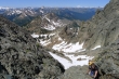
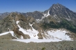
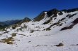
From Ingalls Pass we are looking across Headlight Basin to the three summits of Ingalls Peak.
|
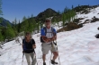
Snowdog and larman in Headlight Basin... Ingalls Pass and 'Not Hinkhouse' Peak are above.
|
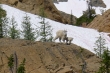
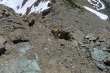
Goats in Headlight Basin.
|
The goats kept an eye on us as we traveled across Headlight Basin.
|
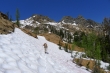
Snowdog leads the way across Headlight Basin... with the Ingalls summits above.
|
larman in Headlight Basin.
|
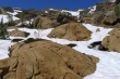
Rock, snow, water and blue sky.
|
Looking back at Ingalls Pass and 'Not Hinkhouse' Peak as we head across Headlight Basin.
|
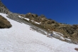
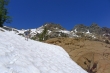
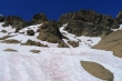
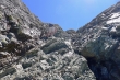
Nearing some nice rock slabs.
|
Getting closer to the rock slabs.
|
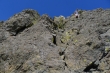
larman on the rock slabs... with Mount Stuart in the distance.
|
A short break on the rock slabs... with the north and east summits of Ingalls Peak above.
|
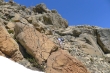
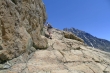
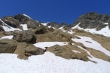
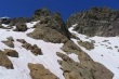
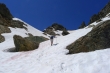
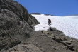
We will continue up alternating between the rock and snow.
|
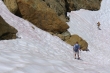
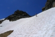
Snowdog coming across a patch of snow... 'Not Hinkhouse' Peak and Ingalls Pass in the distance.
|
larman leading now.
|
Our first good look at Ingalls Lake... with Jack Ridge and Mount Stuart in the distance.
|
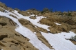
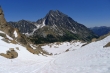
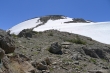
Looking up at the south summit on the left... north summit on the right... and the Dogtooth Crags somewhere in between.
|
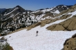
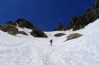
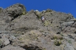
Snowdog leading the way on nice rock slabs... south summit on the left.
|
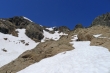
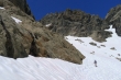
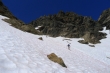
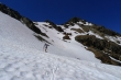
Back on snow and continuing up... south summit on the left.
|
Working our way over toward the north summit... where we will find friendlier terrain leading up to the Dogtooth Crags.
|
We are going to have to give up a little elevation as we work over to the right toward the north summit.
|
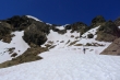
Giving back some elevation and heading toward the north summit.
|
Heading back up now toward the north summit.
|
Continuing toward the north summit above.
|
Looking down at Ingalls Lake and out to Mount Stuart.
|
larman heading up toward the Dogtooth Crags.
|
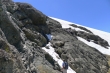
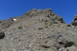
South Ingalls summit on the left... with the Dogtooth Crags on the right.
|
On steeper terrain as we near the Dogtooth Crags.
|
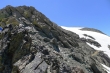
larman nearing the ridge.
|
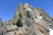
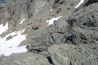
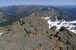
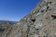
The north summit of Ingalls Peak from the Dogtooth Crags (~7350').
|
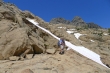
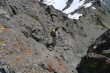
From the Dogtooth Crags we will need to get around this rock outcropping to reach the south summit... the snow is much steeper than it looks in the photo... so it would be nice to find a route on the rock.
|
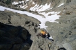
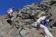
Hey guys, I've found a good route... come on up!
|
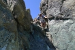
Snowdog working her way up the gully.
|
larman looking for the best way up.
|
This gully will work.
|
Snowdog working the gully.
|
larman is almost at the top of the gully.
|
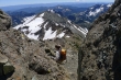
Snowdog ascending the gully... broad views of the Alpine Lakes Wilderness and beyond.
|
One last check of the time to make sure that we are on schedule.
|
Looking over at the north summit as we near the top of the gully.
|
Past the gully now... looks like easy sailing from here to the south summit.
|
Snowdog and larman heading for the south summit.
|
The north and east summits of Ingalls Peak in the left foreground... Ingalls Lake below... then Jack Ridge and Mount Stuart... with Eightmile Mountain and Cashmere Mountain in the distance on the left.
|
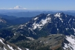
Looking across Hawkins Mountain to Mount Rainier.
|
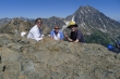
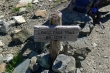
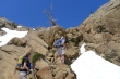
Snowdog, larman and ragman on the South Ingalls summit (7640+).
|
Looking at a lot of the Teanaway Country from the South Ingalls summit.
|
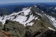
Looking at the ridge that runs over to Fortune Peak... Mount Rainier in the distance on the right.
|
Snowdog looks at a Class 4 gully that leads down to the ridge leading over to Fortune Peak... we will avoid this gully by going around to the left.
|
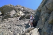
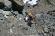
larman coming down the south side of South Ingalls Peak on Class 2/3 terrain.
|
Snowdog descending the south side of South Ingalls... Fortune Peak at the end of the ridge.
|
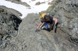
Being very careful here.
|
Snowdog is almost down to easier terrain now.
|
larman coming down the south side of South Ingalls.
|
larman still descending the south side of South Ingalls.
|
On the ridge between South Ingalls and Fortune Peaks... looking back at the south side of South Ingalls Peak.
|
On the west side of a rock outcropping on the ridge between South Ingalls and Fortune... using the classic mountaineering 'butt scoot' technique.
|
Finally around that gnarly rock outcropping... time to get back on the snow and head down to Headlight Basin.
|
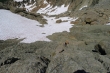
Heading down toward Headlight Basin... with the South Ingalls summit above.
|
Working our way down to Headlight Basin... Mount Stuart in the distance.
|
Back on snow again in Headlight Basin.
|
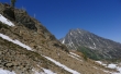
Just a short jaunt over to Ingalls Pass in the left center of the photo... 'Not Hinkhouse' Peak is the pyramid shaped peak just beyond Ingalls Pass.
|
One last look at Ingalls Peak and Headlight Basin from Ingalls Pass... an easy 3.5 mile trail hike will get us back to the car... what a day!
|
