Snoqualmie Mountain - 8.7.2013
|
Directions from Lee's Summit Grocery at Snoqualmie Pass to the Alpental Ski Area parking lot.
|
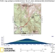
rodman's GPS track of our climb to Snoqualmie Mountain... 3.5 miles roundtrip, gaining 3120 feet of elevation.
|
A google earth look at the terrain around Snoqualmie Mountain.
|
Parking at the Alpental Ski Area parking lot (~3080')... Denny Mountain above.
|
We will use the well-traveled, but unmaintained path that leads up to the Snoqualmie Mountain / Guye Peak Divide.
|
|
The gang on the path that starts across the road from the Alpental parking lot.
|
The path goes steeply uphill... and it doesn't take very long to get a view of Bryant Peak and Chair Peak.
|
We've reached the boulder field at ~4000 feet... looks like Izzy has got a new haircut.
|
At the boulder field stay straight to go to Snoqualmie Mountain or go right for Guye Peak.
|
The stream crossing at 4200 feet was bone dry.
|
|
Out of the trees at ~4800 feet and switchbacking uphill.
|
Summit in view.
|
Ascending and looking south... Guye Peak in the left foreground... Keechelus Lake... Snoqualmie Pass in the center of the photo... with Mt. Rainier in the distance.
|
Almost at the summit now.
|
Ascending and looking east to Red Mountain and Kendall Peak in the foreground... then Chikamin, Four Brothers, Three Queens, Alta and Hibox... with Mt. Stuart in the haze in the distance on the left.
|
|
Looking across the east summit to Overcoat Peak, Chimney Rock, Lemah Mountain and Chikamin Peak.
|
On the true summit (6278') now... looking down on Snow Lake... with foreground peaks of Bryant, Chair and Kaleetan on the left, Roosevelt (center) and Wright (right)... Preacher Mountain on the horizon on the far right.
|
Snoqualmie's east summit from the true summit.
|
Summit Party... BarbE, larman, ragman, rodman, Snowdog and iraman.
|
Heading steeply down now... Alpental in the valley below... Snoqualmie Pass is upper left.
|


