South Sister - 9.9.2013
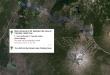
Directions from the main entrance to the Mt. Bachelor Ski Area on Cascades Lake Hwy to the trailhead for the South Sister Climber Trail at the Devils Lake Parking Area.
|
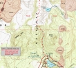
My approximate route from the parking area at Devils Lake to the ridge above Moraine Lake.
|
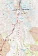
My approximate route from the ridge above Moraine Lake up to the summit of South Sister... the total hike was ~12.5 miles roundtrip, gaining ~5500 feet of elevation.
|
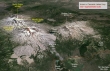
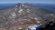
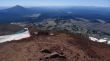
A google earth look at the terrain around South Sister.
|
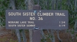
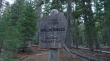
The South Sister Climber Trail starts near the restroom in the Devils Lake parking area.
|
This hike/climb is located in the Three Sisters Wilderness.
|
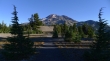
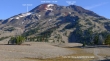
After hiking 1.75 miles I got above the trees and got my first look at South Sister.
|
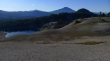
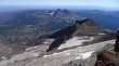
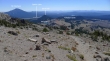
Hiking on the fairly flat ridge above Moraine Lake... Devils Hill in the right foreground... with Mt. Bachelor and Tumalo Mountain in the distance.
|
My approximate route to the summit of South Sister.
|
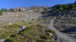
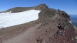
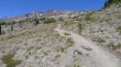
Starting uphill again after the fairly flat hiking above Moraine Lake.
|
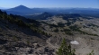
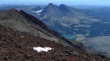
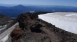
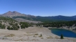
Gaining elevation and looking back to the south at the terrain I just traveled... Mt. Bachelor on the left.
|
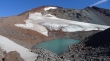
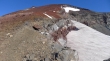
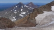
I have reached the 9000 foot tarn at the foot of the Lewis Glacier... the trail will follow along the rib on the left of the photo.
|
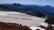
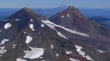
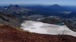
A pano shot at the 9000 foot tarn... the South Sister summit is on the left... with Hodge Crest on the right.
|
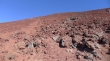
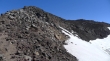
I am on the rib between the Clark and Lewis glaciers... heading up toward the summit.
|
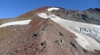
You can see the people on the trail above me... beautiful color in the rocks.
|
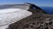
Above the Lewis Glacier now and looking back to the south... Broken Top and Green Lakes on the left... Mt. Bachelor on the right.
|
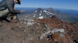
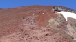
About 500 feet of elevation is left to reach the summit rim.
|
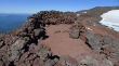
One of several wind breaks on the summit rim area.
|
A poor pano of the rim... but it gives perspective... the true summit is on the north side of the rim... and a trail goes completely around the rim.
|
Starting around the rim... with Broken Top and Green Lakes below.
|
On the rim trail and heading for the true summit.
|
Looking across Hodge Crest to Broken Top.
|
On the rim and looking south to Mt. Bachelor.
|
Self Portrait on the South Sister summit (10,358')... looking north to Middle Sister and North Sister.
|
Looking down on Chambers Lakes from the South Sister summit... is each lake a different color?
|
A closeup of Middle Sister and North Sister... with Mt. Washington, Mt. Jefferson, Mt. Hood and Mt. Adams also visible.
|
Continuing along the rim trail and looking back at the summit area.
|
Two hikers have decided to leave the rim trail and explore the crater area.
|
I left the rim trail and went out into the crater for this photo.
|
Time to head down... looking south.
|
Hikers coming up as I head down.
|
Almost back to the 9000 foot tarn... people coming down and people going up... roughly 75 people on the trail on this Monday.
|
My approximate route on the return to the car.
|
Almost back to the flat hiking above Moraine Lake.
|
Passing above Moraine Lake and looking over to Broken Top... 2.5 miles of easy hiking to get back to the car.
|
