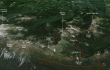
South Slide Mountain - 9.19.2013
Directions to Sunrise Point from the fee station at the White River entrance to Mount Rainier National Park.
|
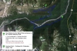
My approximate route to the summit of South Slide Mountain... 9.5 miles roundtrip, gaining 3025 feet of elevation.
|
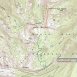
A google earth look at the terrain around South Slide Mountain.
|
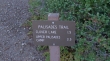
I will use the Palisades Lakes Trail for the the first 3.5 miles of this hike.
|
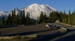
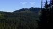
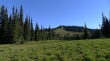
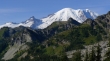
Mount Rainier from Sunrise Point... where I started from the Palisades Lakes Trailhead.
|
From Sunrise Point... Sunrise Lake is below left... South Slide Mountain is on the far right... Marcus Peak and the Palisades are in the center of the photo.
|
After hiking a short distance I will continue toward the upper palisades camp.
|
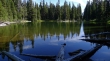
After hiking 1.5 miles I arrived at a frosty Clover Lake.
|
A better look at today's destination.
|
Continuing toward the upper palisades camp.
|
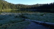
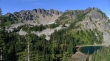
Dick's Lake.
|
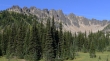
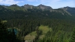
The Palisades... impressive.
|
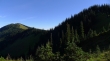
The treed summit of Brown Peak (6322')... I will be up there soon.
|
Gaining elevation on the west ridge of Brown Peak... looking at The Palisades and Upper Palisades Lake.
|
Brown Peak is on my right... with South Slide Mountain on the far left.
|
Mount Rainier comes into view just before I reach the top of Brown Peak.
|
A closeup... looking beyond Marcus Peak to Little Tahoma and Mt. Rainier.
|
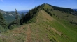
From Brown Peak the route is pretty obvious to South Slide Mountain.
|
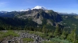
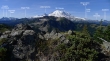
From Point 6480+ I am looking across The Palisades to Mount Rainier.
|
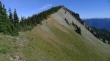
South Slide Mountain from Point 6480+.
|
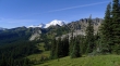
Broad views from the summit (6620') of South Slide Mountain.
|
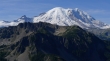
A closeup of Little Tahoma and Mount Rainier from South Slide Mountain... The Palisades in the foreground.
|
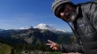
Self-portrait on the summit of South Slide Mountain.
|
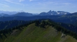
Looking across Govenors Ridge to Mount Adams on the horizon... Goat Rocks on the horizon on the far left... Tamanos Mtn, Cowlitz Chimneys and Banshee Peak on the right.
|
A pano shot from the summit of South Slide Mountain... a 4.75 mile hike with lots of ups and downs to get back to the car.
|
