Chesler Park - 4.30.2014
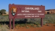
We started hiking from the Elephant Hill Trailhead in the Needles District of Canyonlands National Park.
|
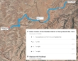
UT Hwy 211 leads to the entrance for the Needles District of Canyonlands... the junction of UT Hwy 211 and UT Hwy 191 is located about 40 miles south of Moab, Utah... and 14 miles north of Monticello, Utah.
|
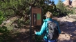
We started at the Elephant Hill Trailhead.
|
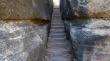
After hiking less than 5 minutes we got to this interesting staircase.
|
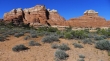
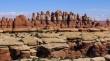
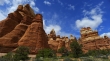
The rock formations are outstanding.
|
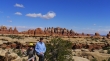
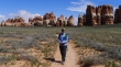
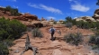
Denali Girl heading for Chesler Park... which is on the other side of the needles in the distance.
|
Lots of daises on the way to Chesler Park.
|
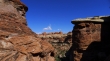
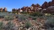
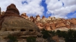
Impressive rock formations everywhere.
|
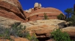
Looks like a space ship.
|
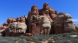
More rock formations.
|
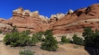
And still more rock formations.
|
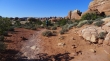
We've reached a small unnamed park... which we will cross... then go through a slot to reach Chesler Park on the other side of the needles in the distance.
|
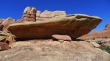
Rock.
|
The path narrows here.
|
Looking through a gap in the rocks.
|
Rock.
|
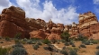
Impressive rock.
|
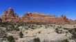
More rock.
|
ragman and Denali Girl.
|
The La Sal Mountains in the distance.
|
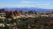
In Chesler Park after hiking 3 miles... lots of Prickly Pear Cactus.
|
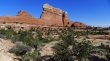
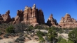
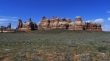
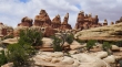
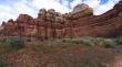
Plenty of rock formations in Chesler Park.
|
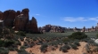
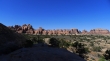
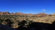
A broader look at Chesler Park.
|
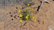
Lots of Evening Primrose in Chesler Park.
|
Denali Girl in Chesler Park... we will make a 5 mile loop hike in Chesler Park.
|
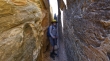
Denali Girl enters the beginning of the Joint Trail.
|
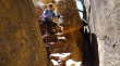
ragman in the slot on the Joint Trail.
|
Very chilly in the slot.
|
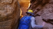
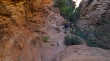
Very narrow in places in the slot.
|
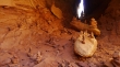
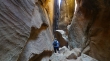
Lots of cairns in the slot.
|
Out of the slot now... and we will work our way back up to Chesler Park.
|
Denali Girl heading for Chesler Park.
|
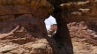
A window?... not really, but close.
|
Almost back to Chesler Park... clouds forming.
|
Lots of purple and white.
|
Back in Chesler Park... where we will close the 5 mile loop.
|
Rock formations in Chesler Park.
|
Rock formations in Chesler Park.
|
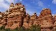
Rock formations in Chesler Park.
|
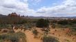
One last look at Chesler Park before we hike the final 3 miles back to the car. This hike was 11 miles roundtrip, gaining about 1200 feet of elevation.
|
