Rock Mountain - 6.11.2014
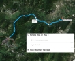
Directions from Stevens Pass on Hwy 2 to the Rock Mountain Trailhead.
|
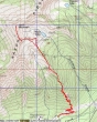
rodman's GPS track from May 1, 2009... the same route we used on this trip... 9 miles roundtrip, gaining 4269 feet of elevation.
|
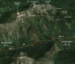
A google earth look at the terrain around Rock Mountain.
|
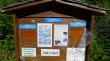
The Rock Mountain Trailhead (~2720') is only a stone's throw from Hwy 2.
|
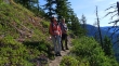
88 nicely graded switchbacks took us from the trailhead (~2720') up to ~5000 feet.
|

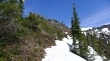
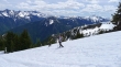
We found the first patches of snow at 5000 feet.
|
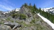
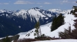
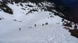
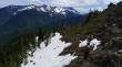
Side-hilling became a nuisance and we decided to head straight up to a rib at ~5200 feet... Nason Ridge on the right.
|
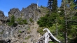
On the rib at 5200 feet... we will follow this rib for more than a half-mile.
|
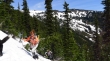
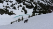
Snowdog and BarbE working along the rib.
|
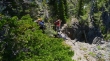
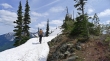
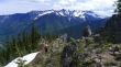
A reasonable boot-path on the rib... the trail is covered in the steep snow below us on the right.
|
BarbE working her way along the rib.
|
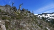
Snowdog took a slightly higher route on the rib than BarbE.
|
We are at the high point (5490') of the rib... but still need to work our way over to the more open terrain.
|
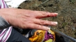
Oh no... a scrape along the rib route... but thank goodness the nail was not damaged.
|
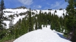
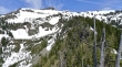
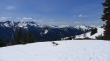
Off of the rocky part of the rib and heading for open terrain... the South Peak of Rock Mountain is above on the left.
|
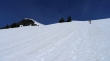
Open terrain now and continuing up... South Peak of Rock Mountain above.
|
BarbE almost to the Rock Lake overlook... South Peak of Rock Mountain on the left.
|
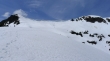
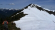
At the Rock Lake overlook (~6200') now... looking up to the South Peak (left) and true summit (right) of Rock Mountain.
|
Izzy poses at the Rock Lake overlook... the lake is just starting to melt.
|
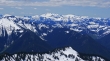
From the Rock Lake overlook we are looking south into the Alpine Lakes Wilderness... with the Chiwaukum Mountains on the left... Jim Hill Mountain in the right foreground... with Mt. Daniel in the distance on the far right.
|
A closeup of Jim Hill Mountain in the foreground... Mt. Daniel on the right.
|
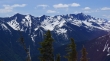
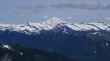
The Chiwaukum Mountains from the Rock Lake overlook. Mount Stuart in the distance on the far right.
|
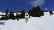
Snowdog, Izzy and BarbE take a break below the South Peak of Rock Mountain.
|
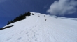
Heading for the South Peak of Rock Mountain.
|
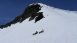
Impressive cornices on the east side of the ridge connecting the south peak and the true summit of Rock Mountain.
|
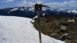
Leaving the South Peak (6640+) and heading for the true summit.
|
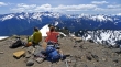
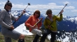
Izzy, Snowdog and BarbE looking at the Alpine Lakes Wilderness from the summit (6840+) of Rock Mountain.
|
A pano shot of the Alpine Lakes Wilderness from the summit of Rock Mountain.
|
Looking north from the Rock Mountain summit to Glacier Peak.
|
Mount Daniel in the center of the photo with the tippy-top of Mt. Rainier behind it.
|
What does the hawk say... win, win, win, win, win.
|
Izzy keeping an eye on Mount Howard and Mount Mastiff.
|
'Ragman and the Ruffles' rock out on the Rock Mountain summit.
|
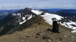
Rock Lake from the Rock Mountain summit.
|
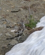
Ptarmigan... nicely camouflaged.
|
On the way down from the South Peak of Rock Mountain... we will follow our steps back down.
|
Izzy and Snowdog heading down.
|
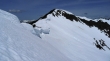
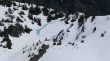
Back on the rocky rib... this turned out to be the crux of the trip.
|
Continuing down along the rocky rib... Chiwaukum Mountains in the distance.
|
Almost off of the rocky rib... we can hardly wait for the 88 switchbacks that will get us back to the car.
|
