Mount Wow - 7.31.2014
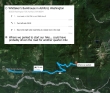
Directions from Whittaker's Bunkhouse in Ashford to where we parked the car to start our hike.
|
rodman's GPS route of our trip to Mount Wow... ~5.5 miles roundtrip, gaining ~3000 feet of elevation.
|
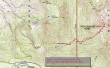
After driving 3.2 miles from Whittaker's Bunkhouse we turned left on FR-59... continued on 59 for 2.7 miles and stayed right where the road forks at a hairpin turn... then continued another .8 miles on a rough road... where we chose to park (~3200') due to poor road conditions.
|
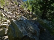
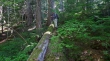
A 5 minute road walk brought us to this spot where a slide has taken over the road.
|
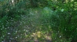
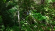
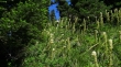
Continuing beyond the slide, flowers and foliage are taking over the road.
|
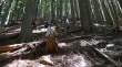
Snowdog and rodman are standing at a key decision point in our trip... the main road continues to the right... but we will head slightly uphill on a seriously overgrown spur road.
|
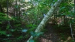
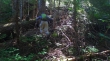
When I say that the spur road is seriously overgrown, I really do mean it.
|
After walking the spur road for ~15 minutes, Snowdog starts bushwhacking (~3400') down to Goat Creek.
|
We had to give back ~50 feet of elevation to get down to Goat Creek.
|
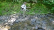
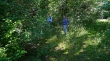
Snowdog has found Goat Creek (3350')... now we will cross it and see what is on the other side.
|
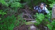
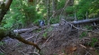
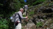
After crossing Goat Creek we had to deal with some devils club and down timber.
|
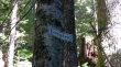
Wow... we are entering Mt. Rainier National Park... bet this sign isn't seen by very many folks.
|
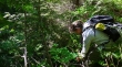
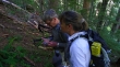
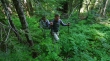
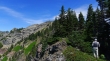
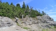
rodman is continuing up in very brushy terrain.
|
Snowdog is enjoying the bushwhack.
|
Oh... the joy of it all.
|
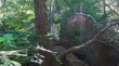
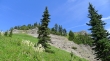
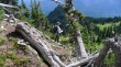
At ~3600 feet the brush eases considerably and we are in old-growth timber.
|
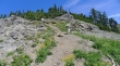
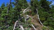
Continuing up on terrain that is pleasant compared to what we found down lower.
|
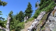
A little brushy... but not bad.
|
Continuing up.
|
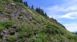
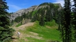
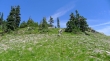
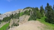
At ~5200 feet we found terrain that was more open.
|
Wading through some beargrass.
|
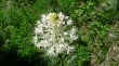
A closer look at one of the beargrass plants.
|
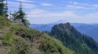
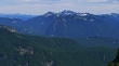
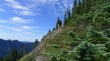
Finally some distant views at ~5400 feet.
|
From Mt. Wow's SW ridge we can see Mount Adams in the distance.
|
We are near Point 5722 and Looking at the cliffs on the west side of Mt. Wow.
|
Snowdog at the saddle just north of Point 5722... the Mt. Wow summit is hidden by the trees above.
|
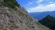
Still gaining elevation.
|
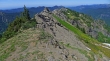
Heading for the cliffy area just below the summit.
|
rodman will follow a ramp out to the skiline... then head up.
|
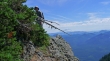
rodman is at the end of the ramp and getting ready to head up again... Mt. Adams in the distance.
|
A pretty good path leads from the ramp up toward the summit.
|
Still ascending.
|
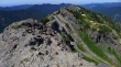
30 seconds from the summit.
|
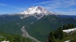
A nice look at the west side of Mt. Rainier from the Mt. Wow summit (6040+).
|
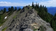
Looking north from the Wow summit... to lots of sub-summits... that first little spire looks like it is higher... so I'm heading over to check it out.
|
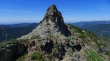
Nearing the spire... pretty obvious that I'm not going to go up it from this side.
|
On top of the spire now... and looking back at Snowdog and rodman... and they are definitely higher than me.
|
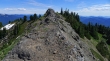
I'm continuing further along Wow's north-south summit area... and looking back at the north side of the spire and on over to rodman on the true summit.
|
Now that point looks higher... so I will keep going along the ridge.
|
Looking back at Wow's true summit.
|
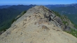
Okay... those two points at the north end of Mt. Wow are definitely lower than where I'm standing... so I will head back to the summit.
|
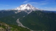
Mt. Rainier from Mt. Wow.
|
The Tatoosh Range from Mt. Wow.
|
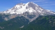
A closer look at Mt. Rainier from Mt. Wow.
|
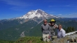
A group shot from Mt. Wow... rodman, ragman and Snowdog... all I can say is wow!!
|
Snowdog heading down from the summit.
|
rodman working down the ramp... which turned out to be the crux move of the hike... Mt. Adams in the distance... Point 5614 in the right foreground.
|
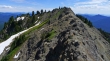
Back down to the saddle on the north side of Point 5722... last good look at Mt. Wow as we continue down.
|
Snowdog getting ready to descend the cliffy area at ~5400 feet.
|
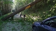
Look what we found on our drive back to Hwy 706. It wasn't there when we drove in earlier in the day. We were very lucky that this bad boy didn't block the road... otherwise, we would still be up there!
|
