Mount Adams - 8.25.2014
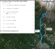
Directions from the junction of Hwy 141 and Mt. Adams Road to the trailhead at Cold Springs Campground.
|
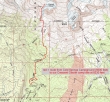
rodman's GPS route from Cold Springs Campground (5600') to our camp (8230') at Crescent Glacier... 3.5 miles, gaining 2679 feet of elevation.
|
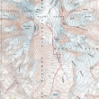
rodman's GPS route from our camp (8230') at Crescent Glacier to the Mt. Adams summit (12,276')... 3.25 miles, gaining 4059 feet of elevation.
|
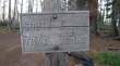
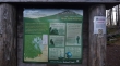
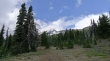
The trailhead sign at Cold Springs Campground (5600').
|
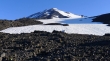
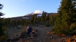
This area was burned by the Cold Creek Fire in 2012.
|
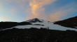
This shows our camp site and approximate route to the summit.
|
After hiking a mile or so we crossed the PCT and the "Round The Mountain" Trail.
|
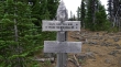
Entering the Mt. Adams Wilderness... located in the Gifford Pinchot National Forest.
|
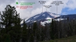
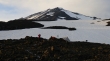
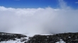
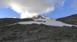
Weather is forming on Mt. Adams... we have already heard some thunder.
|
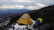
We had planned to set up our camp at Lunch Counter (9400')... however, a rain and hail storm forced us to deploy at 8230 feet... next to Crescent Glacier... Mt. St. Helens in the distance.
|
The hail storm has passed... there are 6 people just above us... and 4 of them are preparing to leave and come back when there is better weather.
|
Looking over at Mt. St. Helens from our campsite.
|
There is a helicopter in the center of the photo... it was there as part of a rescue of a climber with a broken leg.
|
The weather continues to improve... Lunch Counter (9400') is on the flatish area above.
|
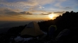
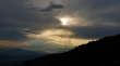
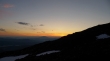
Beautiful sunset from our camp... Mt. St. Helens on the horizon.
|
Weather still improving... with a little alpenglow tossed in for beauty.
|
Two climbers on the ridge (right) enjoying the gorgeous sunset.
|
This is what we woke up to on Monday morning... looks like it is going to be a good one.
|
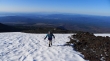
rodman has just left our camp and is ascending toward Lunch Counter... Mt. Hood on the horizon.
|
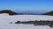
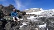
We didn't have running water at our camp... so we will pump some water just below Lunch Counter... Mt. St. Helens in the distance.
|
Now rodman is above Lunch Counter (9400')... lots and lots of camp sites are on Lunch Counter.
|
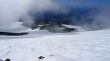
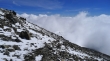
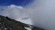
Gaining elevation as clouds roll in over Lunch Counter.
|
Looks like the clouds are going to get us.
|
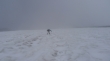
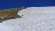
rodman still going up into the void.
|
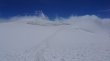
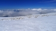
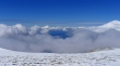
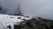
Now we are above the clouds... perhaps at 10,800 feet or so.
|
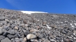
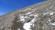
Looking up toward Pikers Peak.
|
rodman nearing the west shoulder of Pikers Peak.
|
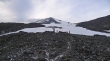
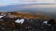
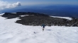
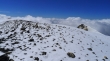
First good look at the Mt. Adams summit... taken from the west shoulder (~11,400 feet) of Pikers Peak.
|
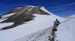
On the west side of Pikers Peak... and heading for the Mt. Adams summit.
|
Looking back at Pikers Peak as we head for the Adams summit... the clouds are chasing us.
|
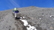
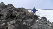
rodman on a good path that will take us to the Adams summit.
|
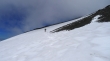
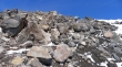
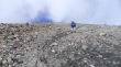
Still gaining elevation on the way to the Mt. Adams summit.
|
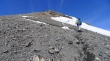
Getting really close to the Mt. Adams summit.
|
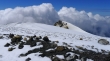
rodman is just below the old lookout building on the Mt. Adams summit.
|
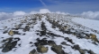
Looking back toward Pikers Peak as the clouds are rolling in.
|
From the Adams summit (12,276') I can barely see the top of Mt. Rainier to the north.
|
The lookout building is on the far left... with The Pinnacle on the right.
|
A sucker hole in the clouds.
|
rodman is checking out a few wind-breaks that were an eighth of a mile from the lookout.
|
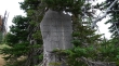
A closer look at The Pinnacle.
|
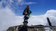
The roof of the lookout building.
|
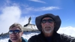
A selfie of rodman and ragman on the Mt. Adams summit.
|
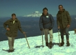
rodman (far left) first climbed Mt. Adams in 1968... with Mt. Rainier in the distance.
|
We are leaving the summit and heading down toward Pikers Peak... sure glad we have a GPS with us.
|
rodman leaving the Adams summit.
|
Looking down toward Lunch Counter from Pikers Peak.
|
rodman coming down from Pikers Peak.
|
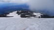
Descending from Pikers Peak... and looking down on Lunch Counter.
|
Looking up at the Adams summit area from our camp... we will pack up and see if we can get back to the car before dark.
|
It is 8:00 pm and we are still 2 miles from the trailhead... it was dark when we got back to the trailhead at 8:45 pm... so we slept in the car and drove home early the next morning.
|
