Bearhead Mountain and Bearhead's East Peak - 9.28.2014
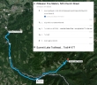
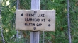
Directions from the Fire Station in Wilkeson to the Summit Lake Trailhead.
|
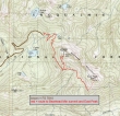
Our approximate route to the main summit of Bearhead Mountain and Bearhead's East Peak... ~9 miles roundtrip, gaining ~2900 feet of elevation.
|
The Summit Lake Trailhead is located at ~4400 feet.
|
Bearhead Mountain is located in the Clearwater Wilderness.
|
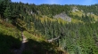
After hiking the Summit Lake Trail for ~1 mile we arrived at Twin Lake (4800') and headed for Bearhead Mountain.
|

Nice reflections on Twin Lake.
|
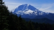
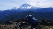
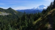
This was the only view of Mt. Rainier as we hiked along the west side of Bearhead Mountain.
|
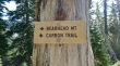
The trail for Bearhead Mountain was ~1.25 miles from Twin Lake... but for now we will continue on the Carbon Trail and head for the East summit of Bearhead.
|
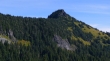
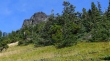
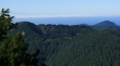
Shortly after bypassing the trail up to Bearhead Mountain, we got a good view of the East Peak of Bearhead Mountain... we will continue on the Carbon Trail... then leave the trail near the far right side of the photo and head off-trail for the summit.
|
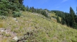
Off-trail now... we will just follow our noses up... with the summit up there somewhere.
|
Still ascending... basically following a ridge toward the summit.
|
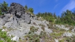
The summit looks problematic from here, but will turn out to be an easy Class 2 scramble from the east side.
|
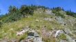
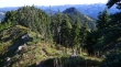
Still ascending... there were several rock outcroppings that were easy to go around.
|
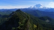
Little Tahoma and Mount Rainier from the East Peak (6041') of Bearhead Mountain... Burroughs Mountain and The Sluiskins stand out on the far left... with Mother Mountain and Fay Peak on the far right.
|
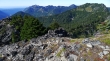
The main summit of Bearhead Mountain is in the right foreground... with Pitcher Mountain and Old Baldy Mountain on Carbon Ridge in the center of the photo.
|
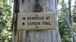
We are back at the junction of the Carbon Trail and the .75 mile trail that leads up to the main summit of Bearhead Mountain... might as well go on up.
|
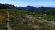
The trail up to Bearhead Mountain is in great shape. The summit is up there somewhere.
|
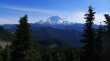
Continuing on the trail up to Bearhead Mountain... Bearhead's East Peak is on the left... with Little Tahoma and Rainier in the distance.
|
Summit Lake from the Bearhead Mountain summit (6089').
|
Mount Rainier from the Bearhead Mountain summit.
|
We decided to follow the path that goes east from the Bearhead summit for an eighth of a mile over to the bump in the foreground to see if it offered a better view.
|
Sure enough, the bump about an eighth of mile east of the main summit offered an unobstructed view... with Bearhead's East Peak in the foreground... and the big white thing in the distance.
|

A selfie (plus Denali Girl) from the bump just east of the Bearhead summit.
|
Heading back to Bearhead's main summit... where we will start the 3 mile hike back to the car... Pitcher Mountain in the center of the photo... with Summit Lake on the shelf to the far right.
|
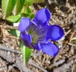
Lots of Gentiana on today's hike... signaling the end of summer... ugh!
|
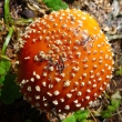
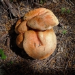
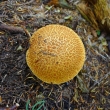
Mushroom.
|
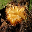
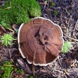
Mushroom.
|
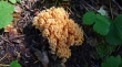
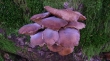
Mushroom.
|
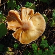
Mushroom.
|

Mushroom.
|
Mushroom.
|
Mushroom.
|
Mushroom.
|

Mushroom.
|
Mushroom.
|
