Earl Peak and Bean Peak - 10.2.2014
|
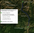
Directions from the entrance to 29 Pines Campground to the Bean Creek/Beverly Turnpike Trailhead.
|
rodman's GPS track of our hike to Earl Peak and climb of Bean Peak... 7.5 miles roundtrip, gaining 3835 feet of elevation.
|
We parked (~3600') at the Beverly Turnpike Trailhead... and will hike it for a half-mile... then take the Bean Creek Trail.
|
Izzy knows to take the Bean Creek Trail after hiking a half-mile on the Beverly Turnpike Trail.
|
The crossing of Bean Creek was a piece of cake.
|
|
~1 mile after crossing Bean Creek we got a good view of Earl Peak on the right.
|
They have altered the trail that goes up toward Earl Peak. It still crosses Bean Creek for the second time... but it doesn't cross the creek until you hike a bit further up toward Bean Creek Basin.
|
We have made the second crossing of Bean Creek and looking at Bean Peak at the head of the valley.
|
We are now switchbacking up toward Earl Peak... and looking at Bean Creek Basin in the center of the photo... with Judy Peak and Mary Peak on the left... and Bean Peak (orange) on the right.
|
We are at the saddle (~6200') that separates Bean Creek and Standup Creek. We have left the main trail and are heading north toward Earl Peak on a good path.
|
|
Continuing toward Earl Peak on a good path... we can't see the summit yet.
|
larman continuing toward Earl Peak... with Bean Peak (orange), Mt. Stuart and Sherpa Peak in the distance.
|
Finally we can see the Earl Peak summit... a good path will take us to the summit.
|
Bean Peak in the left foreground... Fortune Peak and Ingalls Peak in the distance on the left... with Mt. Stuart and Sherpa Peak on the right... looking through the gap to Fish Eagle Peak, The Cradle and Harding Mountain.
|
Volcanic Neck is in the foreground... with Mt. Stuart and Sherpa Peak beyond... The Cradle and Harding Mountain in the distance on the far left... with Argonaut Peak on the far right.
|
|
rodman, Snowdog and larman on the Earl Peak summit... with Argonaut, Colchuck, Dragontail and Little Annapurna in the distance.
|
Most of the Stuart Range from the Earl Peak summit.
|
Bean Peak (orange) is in the center of the photo... we will follow the ridge from Earl Peak over to it... Bean Creek Basin is lower left.
|
Group shot from the Earl Peak summit (7036')... rodman, larman, Izzy, Snowdog and ragman.
|
Leaving the Earl Peak summit... on the ridge that will lead over to Bean Peak.
|
|
On the ridge between Earl Peak and Bean Peak... looking east at Navaho Peak and Little Navaho in the foreground... and the West summit of Three Brothers beyond... Miller Peak on the far right... and McClellan Peak on the far left.
|
The Earl Peak summit is on the far left... as rodman works his way along the ridge as we have to give up 600 feet of elevation.
|
Three dudes and a cutie on the ridge between Earl Peak and Bean Peak.
|
Snowdog and rodman giving up some elevation as we head for Bean Peak.
|
Most of the Stuart Range.
|
|
Looking back at Earl Peak... we have given up ~600 feet of elevation and will continue toward Bean Peak.
|
We can see Prusik Peak through the gap between Little Annapurna and McClellan Peak.
|
Looking back at Earl Peak as we continue along the ridge between Earl Peak and Bean Peak.
|
Yes, it is a ridge... but it is a ridge with lots of ups and downs... and lots of boulders.
|
Our next target is Bean Peak (center)... with Mt. Stuart and Sherpa Peak beyond on the right.
|
|
Snowdog working around one of the many rock outcroppings on the ridge between Earl and Bean Peaks.
|
Continuing on the ridge between Earl Peak and Bean Peak... still a couple of rock outcroppings to deal with.
|
Almost to the Bean Peak summit block.
|
Looking over at Argonaut, Colchuck, Dragontail, Little Annapurna and McClellan.
|
We chose a sporty Class 3 route at the Bean Peak summit block... staying more on the east ridge... as opposed to taking the easier route from the south.
|
|
Climbing Bean's summit block now... looking back at Earl Peak... and the ridge connecting Earl and Bean.
|
larman and rodman coming up.
|
Snowdog continues toward the Bean Peak summit.
|
rodman and larman coming up... Earl Peak on the left... with Bean Creek Basin below.
|
Snowdog continues up... are we having fun yet?
|
|
larman and rodman still ascending... Bean Creek Basin is below.
|
Almost at the Bean Peak summit... the Hardscrabble Creek Basin is below left.
|
Snowdog is on the Bean Peak summit.
|
A selfie (plus 3) from the Bean Peak summit (6743').
|
Stuart Range peaks from the Bean Peak summit.
|
|
A pano shot from the Bean Peak summit.
|
Snowdog heading down the south side of Bean Peak.
|
larman and rodman start down the south side of Bean Peak.
|
rodman and larman descending the south side of Bean Peak.
|
Hanging out in Bean Creek Basin... with Bean Peak beyond... we have ~2.5 miles of hiking to get back to the car.
|


